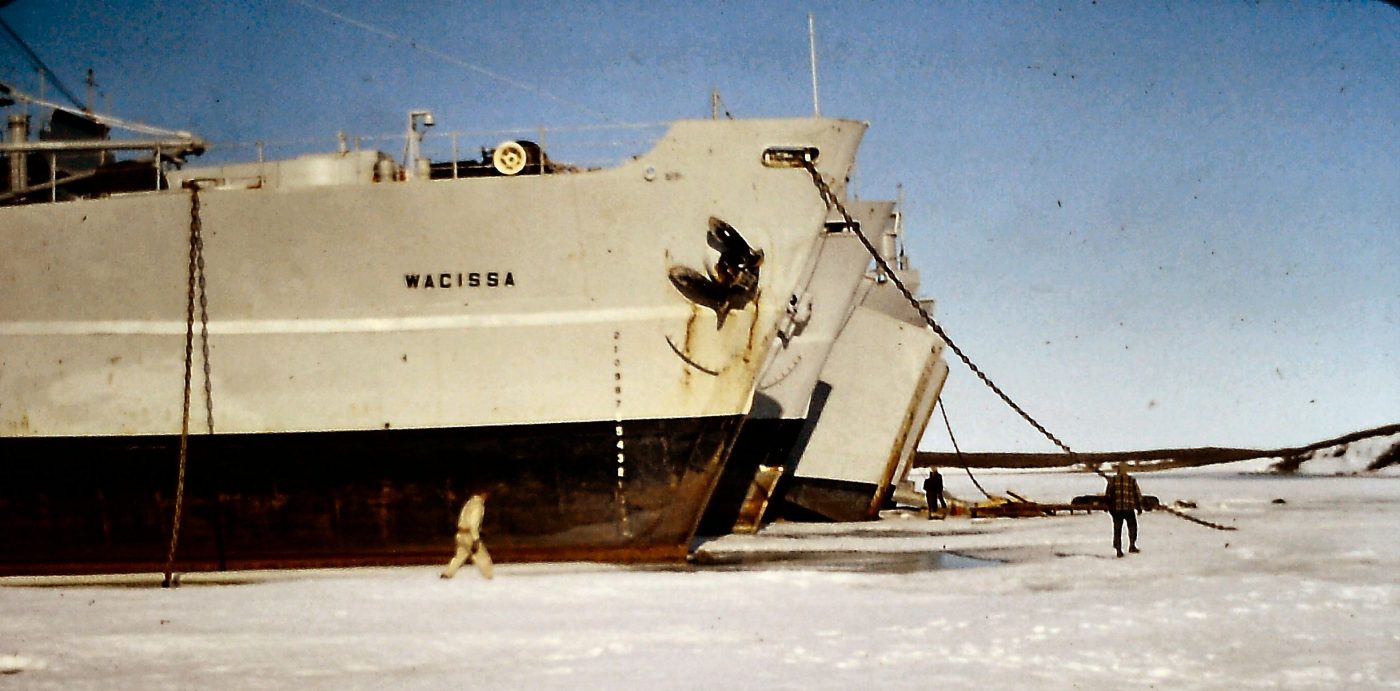
The experiences of Jean-Louis Arès while with the Northern Transportation Company Limited at Tuktoyaktuk
Tuktoyaktuk , Inuvik, and Western Arctic sites today.
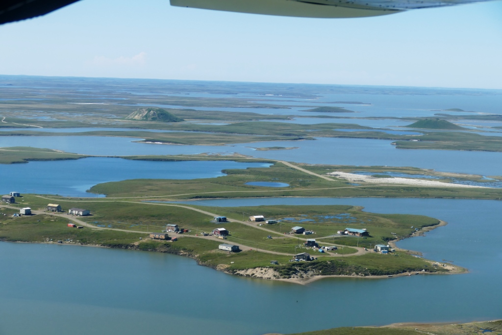
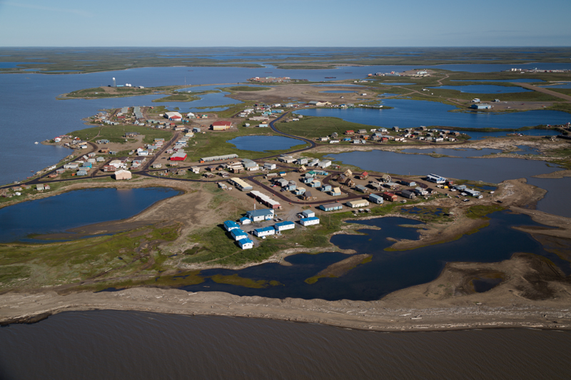
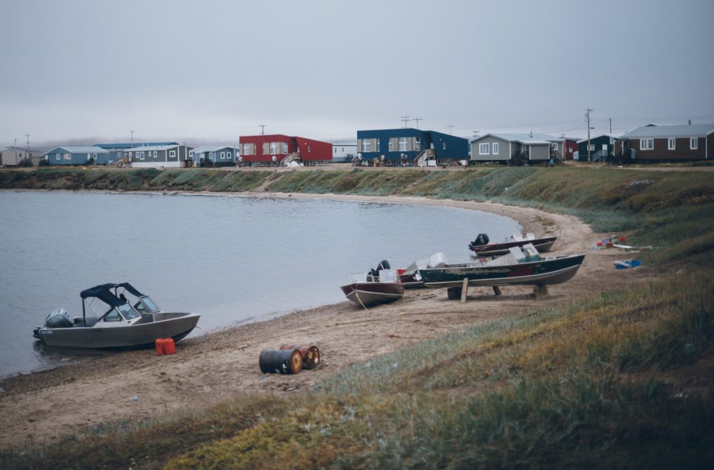
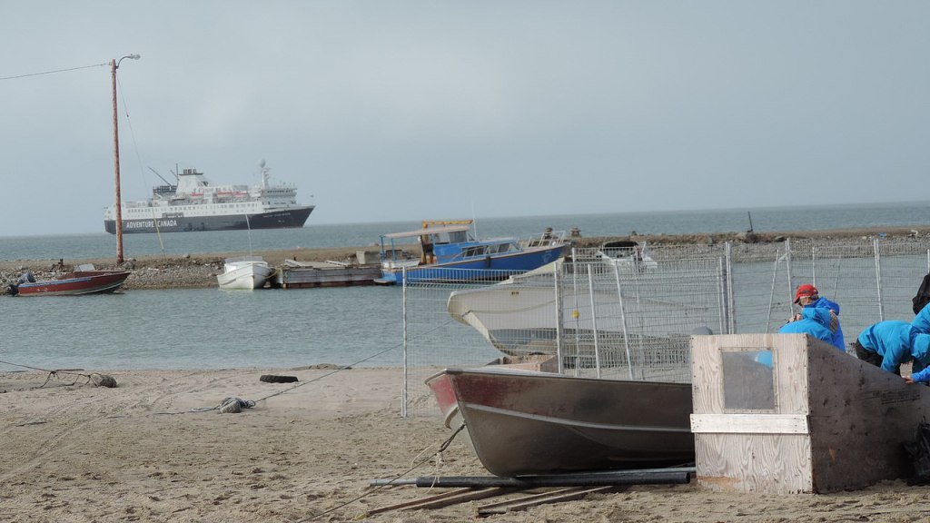
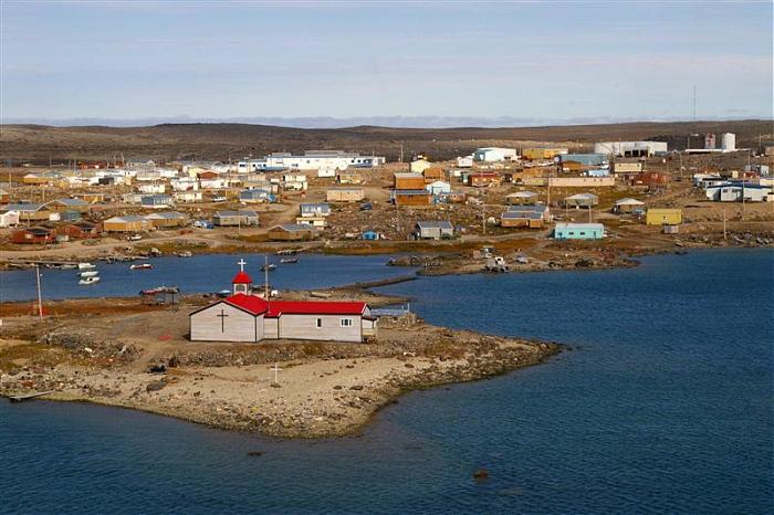
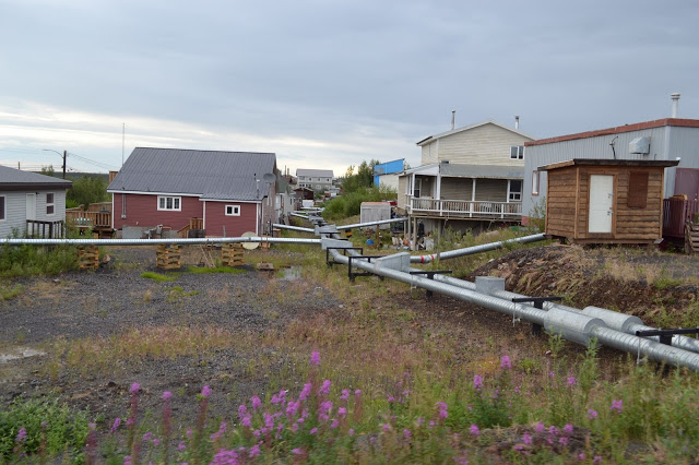
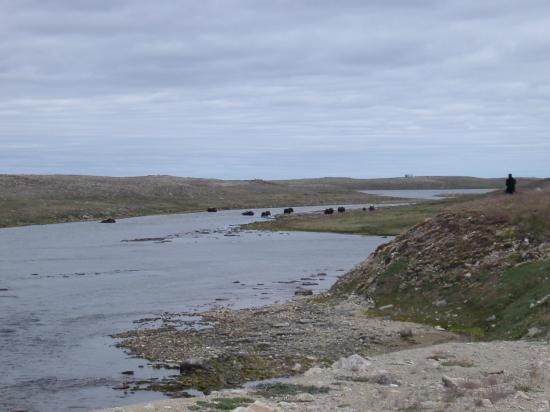
Tuktoyaktuk
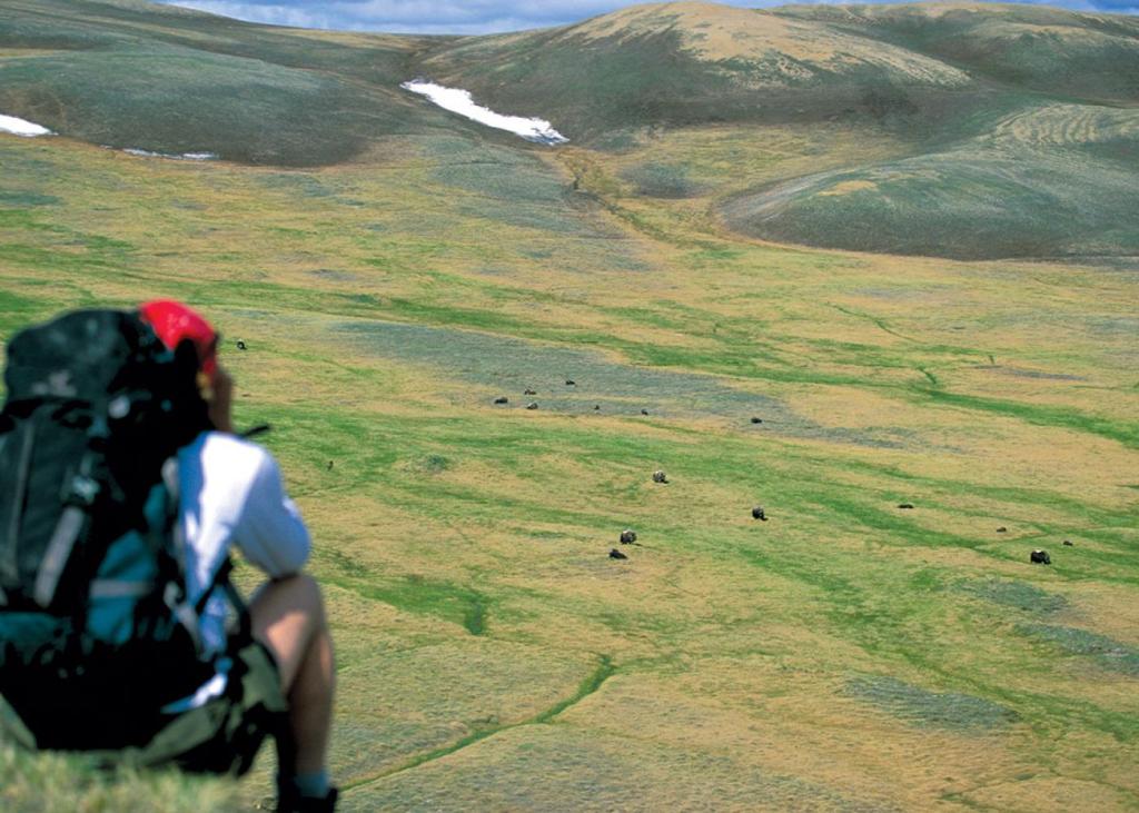
A lot has changed in the Western Arctic since I worked there in 1961,1962 and 1963. That was nearly 60 years ago, from 1961. Tuktoyaktuk had a population of around 450 in the early 60’s. Now Tuktoyaktuk’s population is 995.
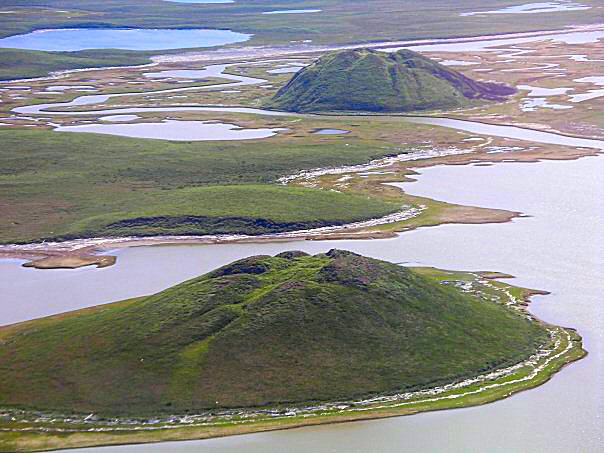
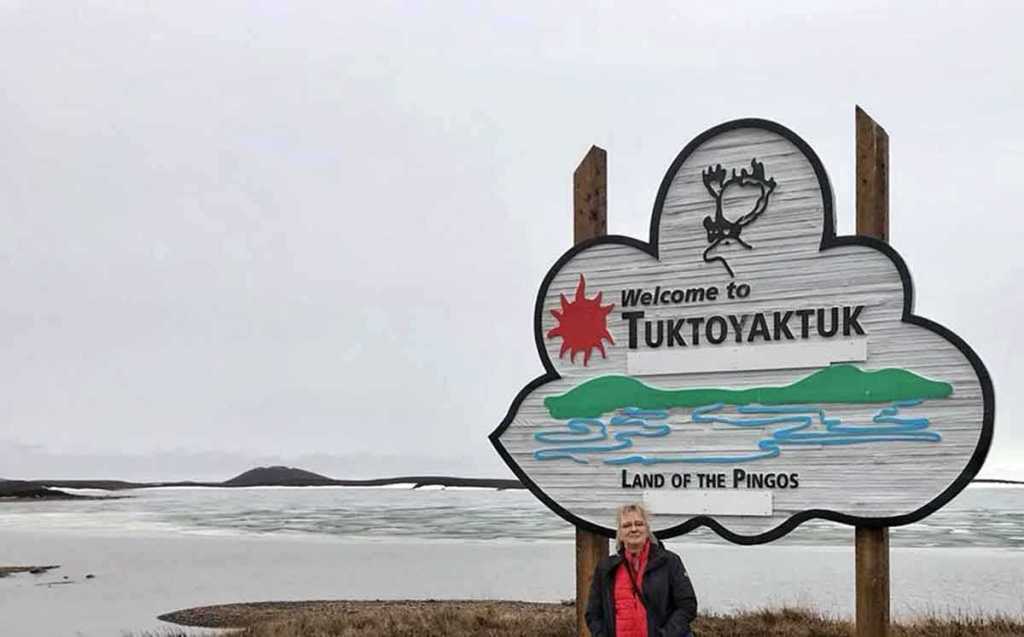
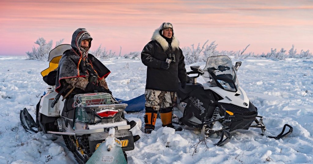
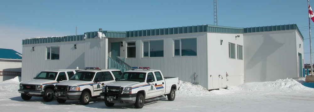
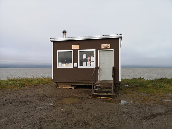
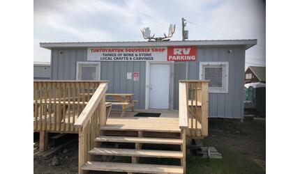
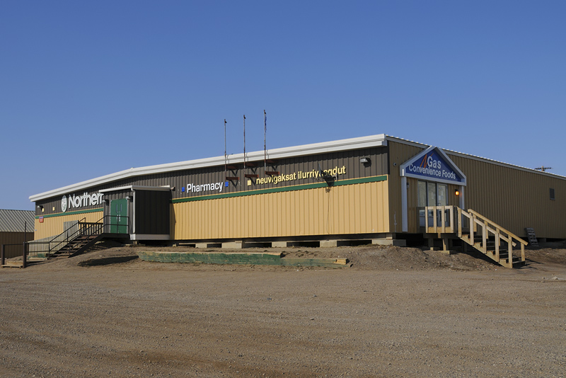
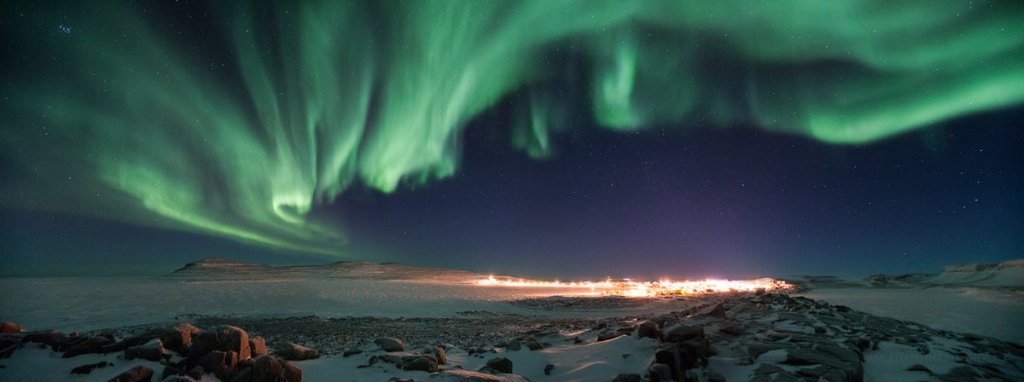
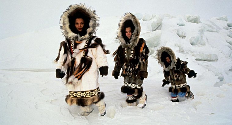
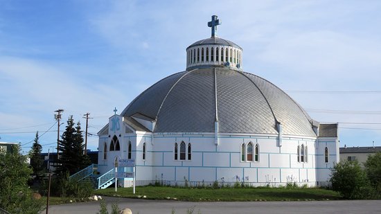
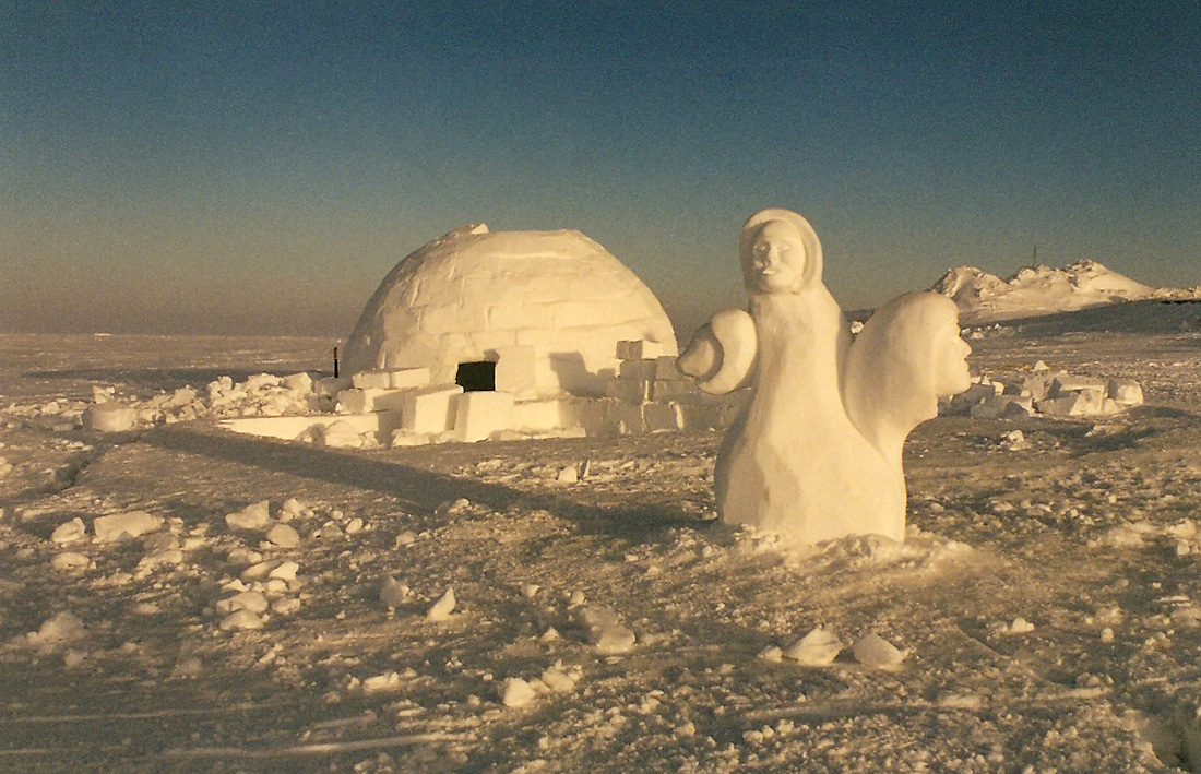
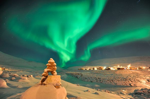
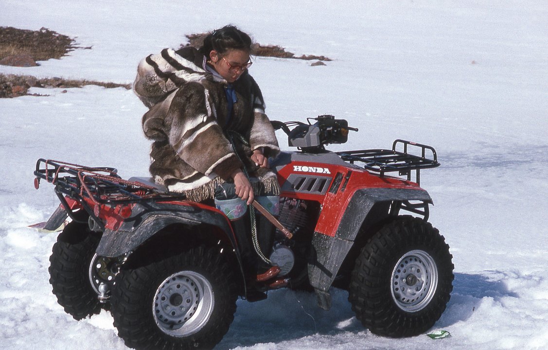
A familiar landmark in Ttuktoyaktuk, now a National landmark. 2 pingos near Tuktoyaktuk. Photo by pl.wikipedia.orgWelcome to Tuktoyaktuk, Land of the Pingos. Photo by roadstories.ca. View of Tuktoyaktuk now. Photo by webbikeworld.com.Trans Canada Trail marker in Tuktoyaktuk. Photo by lonepinephoto.ca.Photo of the renovated Our Lady of Victory Catholic church in Tuktoyaktuk. photo by olvinuvik.com. Snowmobilers in Tuk. They, along with ATV’s, replace the old dog teams. Photo by nytimes,.com. Tuktoyaktuk and 3 pingos from the air. Photo by tripadvisor.ca. Tuktoyaktuk from the air. DEW line site top left. Photo by pinterest.com.Mangilaluk School in Tuktoyaktuk. Photo by bdec.nt.ca. RCMP detachment building in Tuktoyaktuk. Photo by rcmp-grc-gc.ca. Inukshuk and Northern Lights(Aurora Borealis) in Tuktoyaktuk. Photo by arcticstock.ca. Igloo and snow carving. Photo by tripadvisor.ca Inuit lady on an ATV. Beats a dog team anytime. Photo by jontyman.com. Beautiful ladies in Inuit parkas. photo by spectacularnwt.com. More Inuit fur dolls. Photo by pintertest.com.Tuktoyaktuk Tourist Information Centre. Photo by tripadvisor.caTuktoyaktuk Souvenir store. Photo by nwtarts.comTuktoyaktuk Northern General store. Photo by trekearth.com. The Northern stores have replaced the Hudson Bay stores in the Arctic. The paragraph next is an explanation of this.
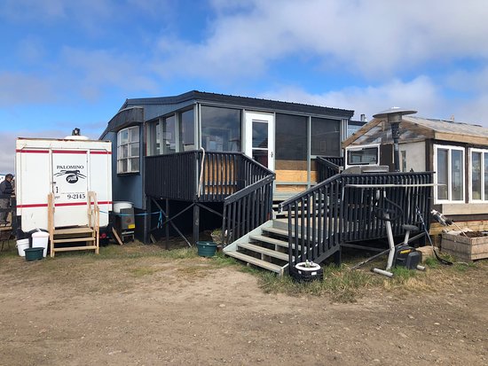
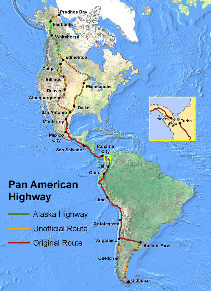
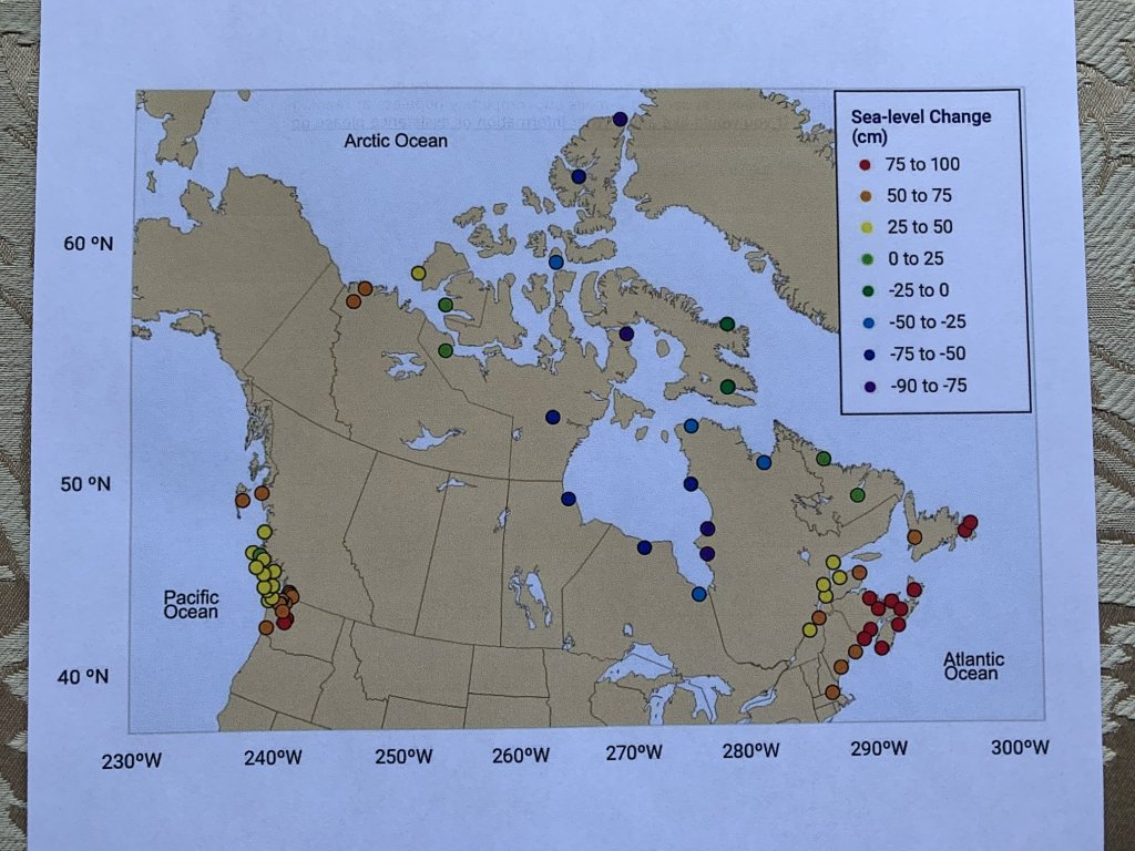
Grandma’s Kitchen Restaurant. Photo by tripadvisor.ca. Where to stay in Tuktoyaktuk. Smitty’s Bed and Breakfast. Photo by tripadvisor.com. Inuit dancers in Tuktoyaktuk. Photo by pinterest.comDid you know that you can now drive all the way from Prudhoe Bay in Alaska to Ushuaia at the southern tip of South America. One can also drive Tuktoyaktuk on the Dempster Highway , through Dawson City, Yukon, to Edmonton and then the rest of the way. Map by en.wikipedia.org. The biggest threat to Tuktoyaktuk’s future now is coastal erosion due to climate change.Tuktoyaktuk is losing a lot of land to climate change says Mayor Merven Gruben (April 12,2019).The above map shows the projected sea level rise on the coastline by 2100. Posted by cbc news ,April 2019.
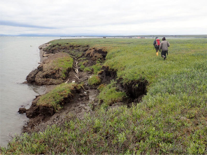
Erosion on the shoreline of Herschel Island, Yukon. Photo by cbc.ca.
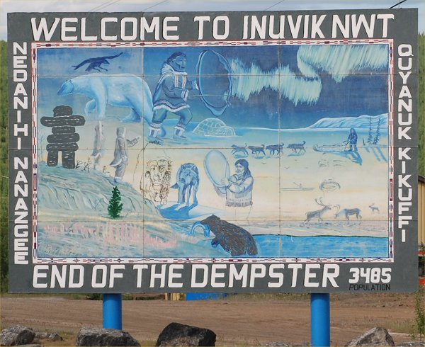
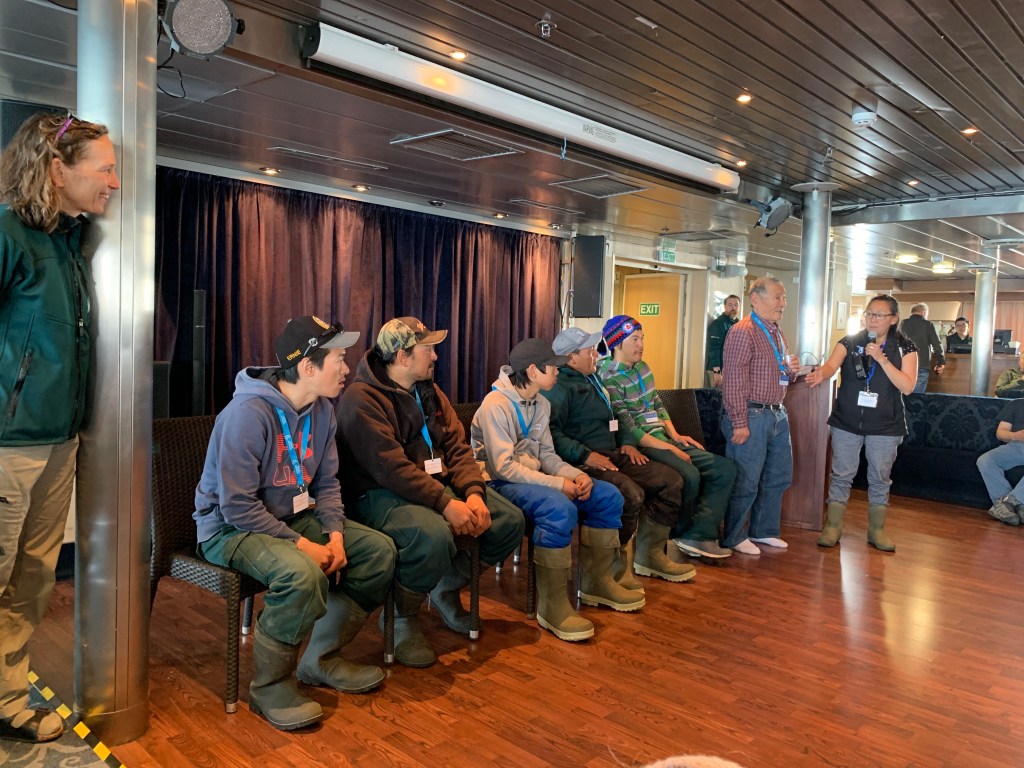
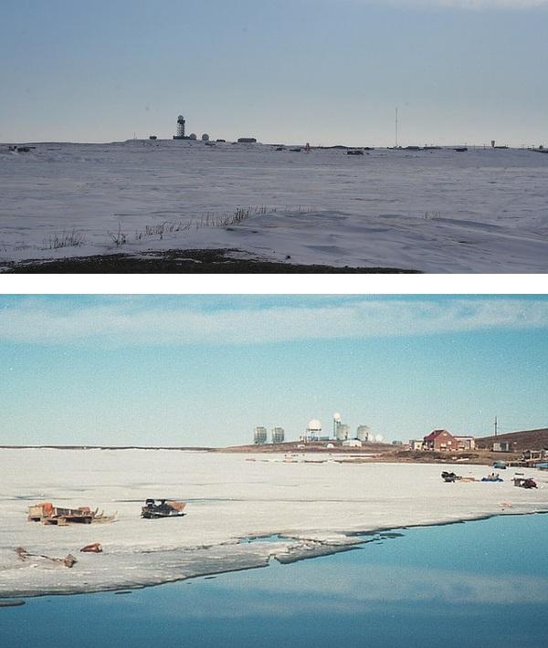
INUVIK-population now is around 3600.
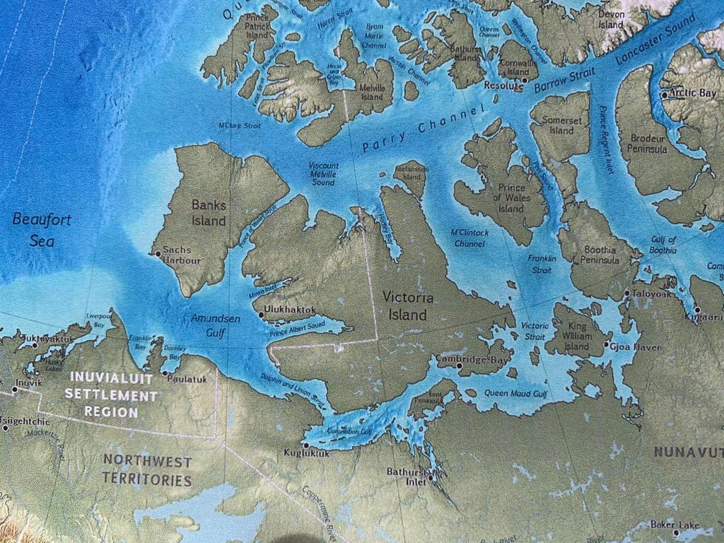
Western Arctic map of place names. Map from Canada’s Arctic Marine Atlas, oceansnorthorg.
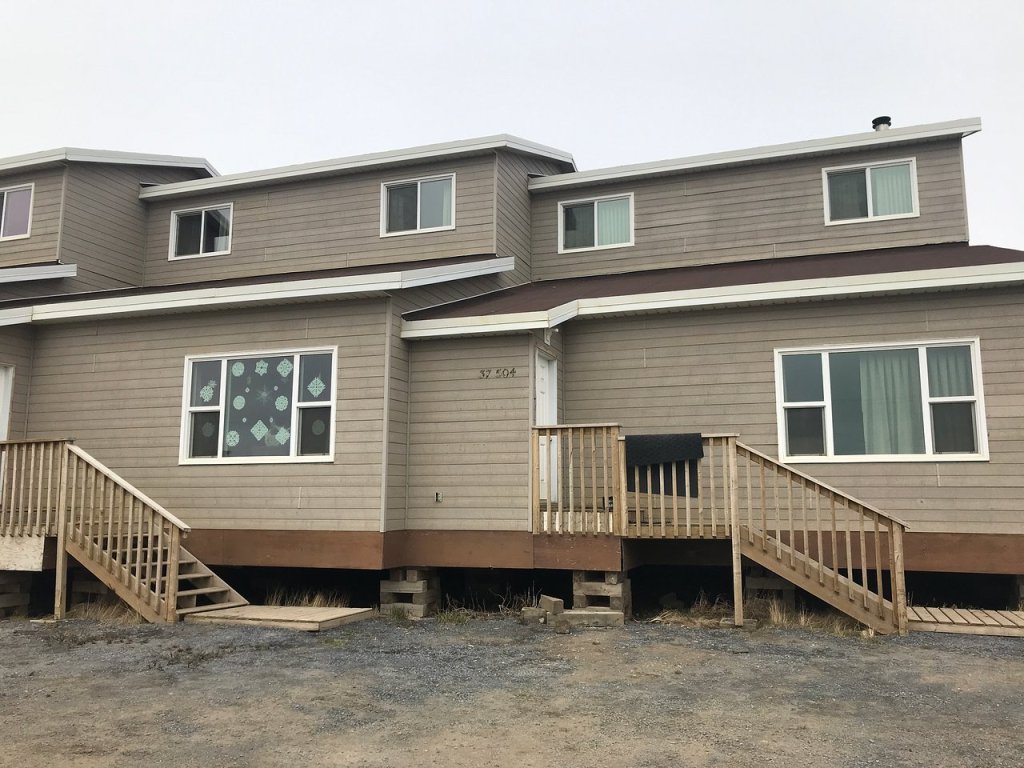
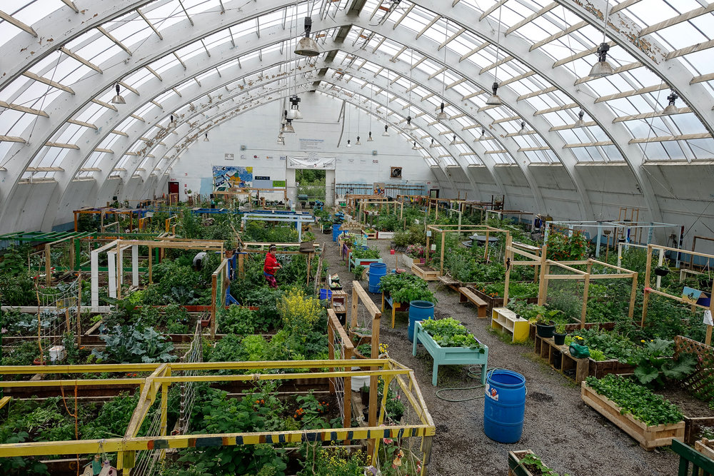
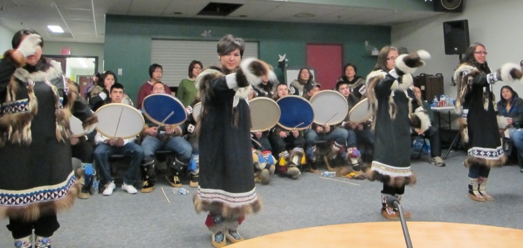
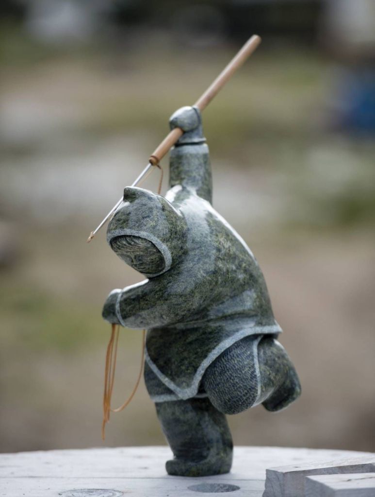
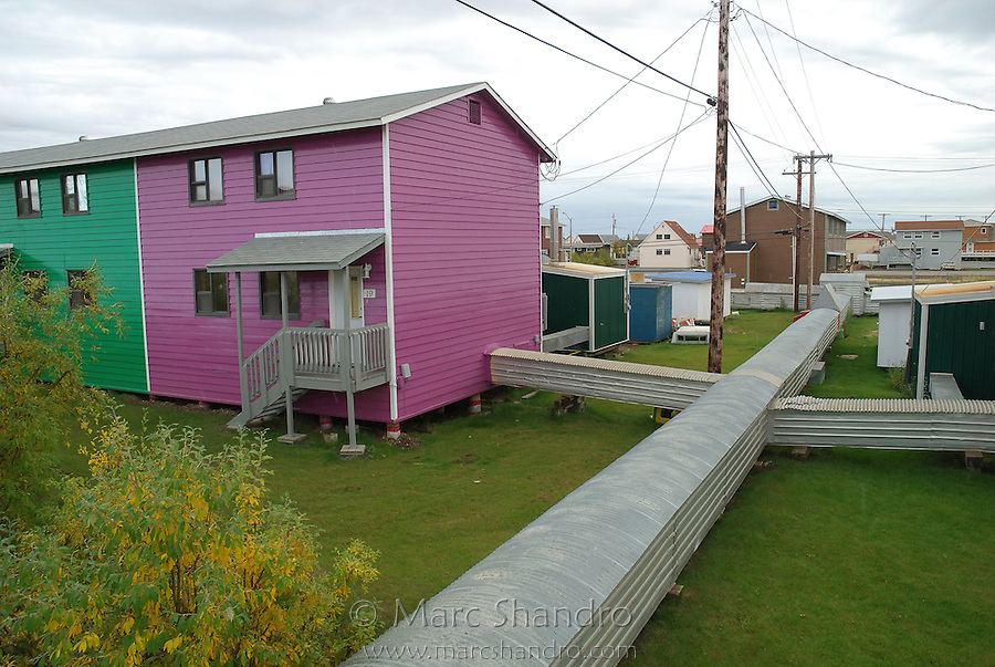
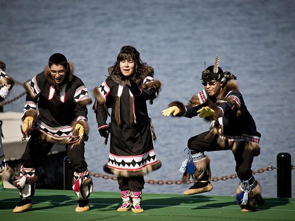
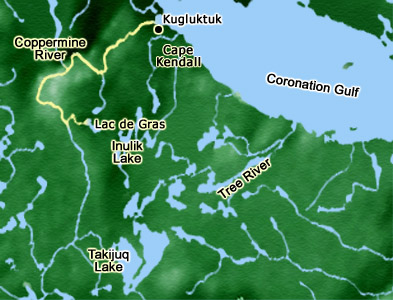
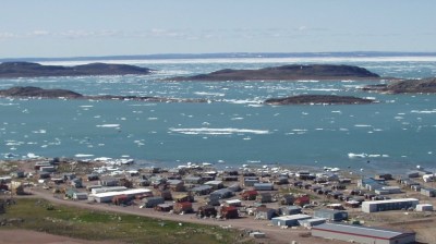
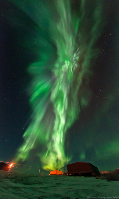
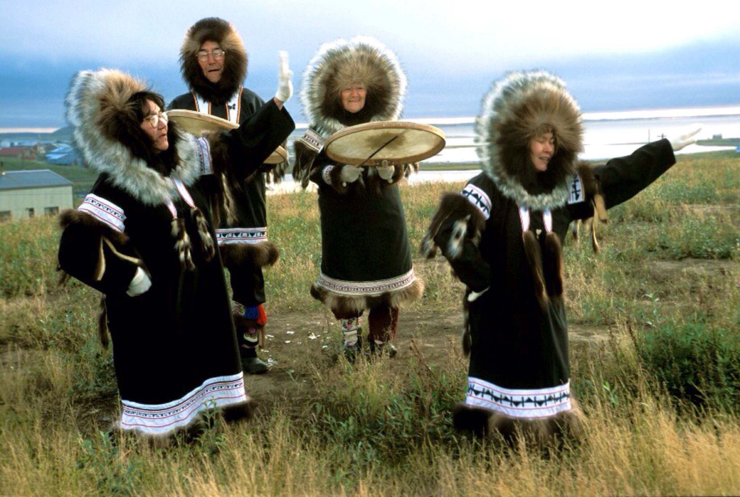
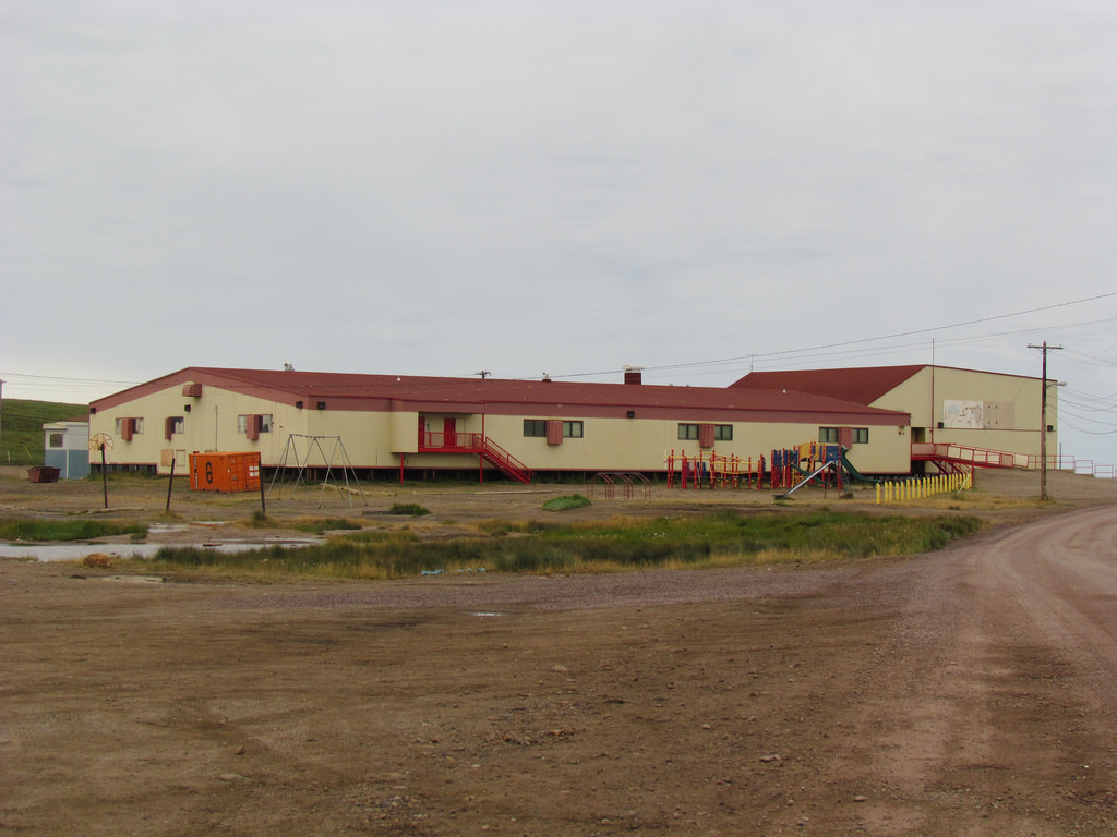
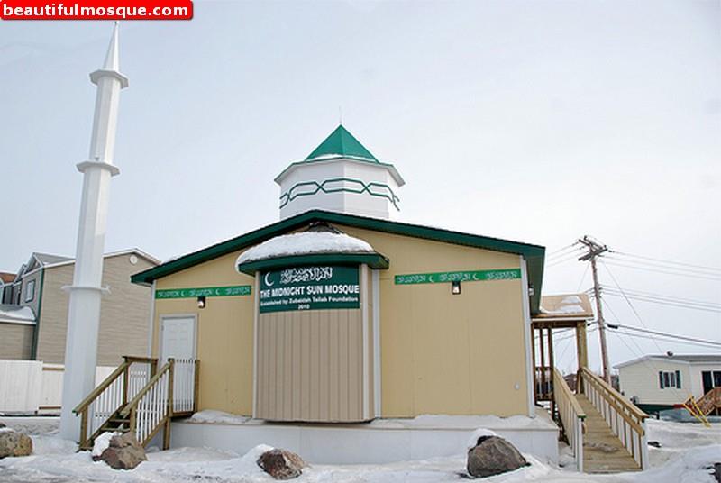
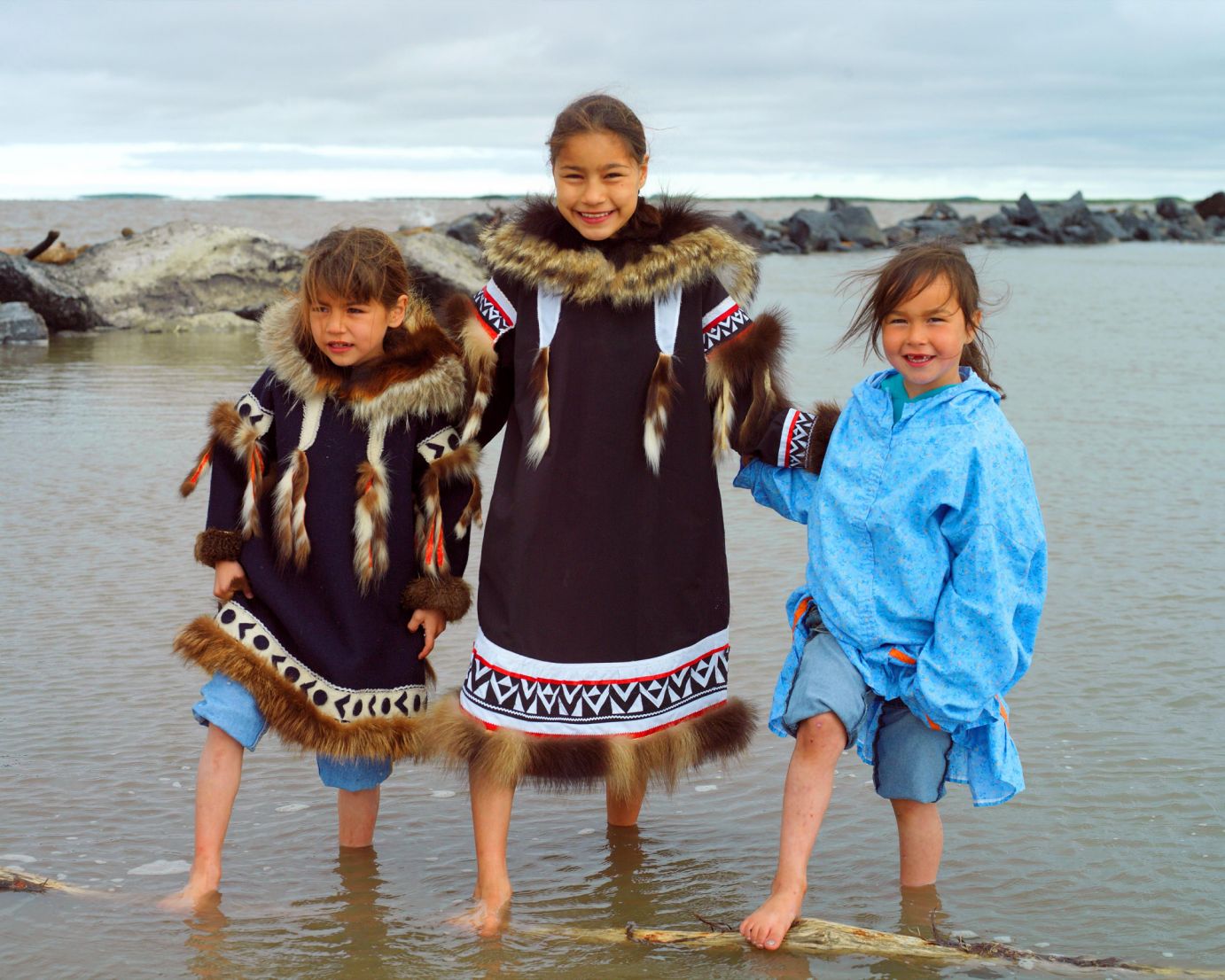
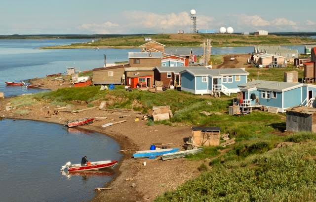
Places of note from West to East are Tuktoyaktuk, Inuvik, Sachs Harbor on Banks Island, Paulatuk, Ulukhaktok (formerly Holman Island), Kugluktuk(formerly Coppermine) , Cambridge Bay, Gjoa Haven on King William Island ( Franklin’s ships discovered ), and Taloyoak on the Boothia Peninsula. Our Lady of Victory “Igloo” Catholic church in Inuvik. Photo by olvinuvik.com.The Midnight Sun Mosque in Inuvik. Photo by beautifulmosque.comThe resourceful people of Inuvik converted an old ice arena into the Inuvik Community Greenhouse. It is likely Canada’s most northern commercial greenhouse. They take advantage of 24 hour summer sunshine to grow fruits, vegetables and plants. Photo by latitude14.com.Inuvik is a great place to observe the mesmerizing Aurora Borealis. Photo by arctickingdom.com. Inuvik Drum Dancers, Photo by topoftheworldgirl.weekly.com.Inuit at work on a sculpture with a handpiece. Photo by gnaf.org. Both Derrald and Taylor. We , as dentists, are quite familiar with these slow speed handpieces. I saw some of these handpieces being used to carve green jade sculptures in Mae Sai, Northern Thailand, bordering on Myanmar. Inuit hunter with spear. Carving by Archie Ishulutak. Utilities in Inuvik, and many larger Arctic communities , can’t be put underground because of the permafrost, so water, electricity, sewage is housed in these above ground utilidors. Photo courtesy of marcshandro.com. Also by flickr.com. Utilidors. Photo by mountainsofttravrlphotos.comDuplex above ground . Photo by K Dewey.jpg.
We did not visit all the following towns, Sachs Harbour, Ulukhaktok, Paulatuk , Kugluktuk and Gjoa Haven in my 2 years with the LST 1072 and the tanker Wacissa. Going East from Tuktoyaktuk, we did go to Cambridge Bay and Taloyoak and a few other DEW Line sites. My brother Richard worked on the tanker Pinnebog and did go to Holman (Ulukhaktok) and said it had a beautiful harbour. In my years travelling back and forth in the Western Arctic we did pass all of these towns. The Banksland freighter did also service these towns as there were Hudson Bay stores there at that time. Now , most of the HBC stores are gone replaced by Northern stores.
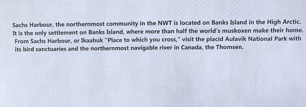
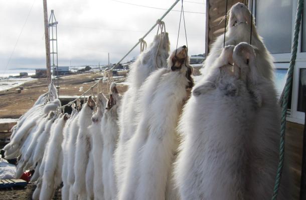
Sachs Harbour. Population 103.
Musk Ox at Sachs Harbour. . Banks Island has more then half of the world’s musk ox. Photo by cbc.ca.
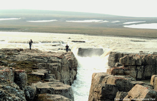
Sachs Harbour . Photo by pharmacie-wilquin.be.Valuable Arctic white fox pelts from a flourishing white fox population. Photo by irc.inuvialuit.com. Aulavik National Park, Banks Island. Musk Ox in the valley. Photo by spectacularnwt.com. Aulavik National Park. Mercy Falls on Thomsen River. Photo by aquaticuoguelp.ca.
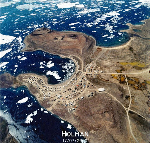
ULUKHAKTOK Ulukhaktok (Holman Island), or Uluksaqtuuq, (meaning “place where one finds material to make ulus”) is located on the west side of Victoria Island and is the most eastern Inuvialuit community. With a population of almost 500, Ulukhaktok also holds traditional ties with the Inuit of the central Arctic.
Culture is very much alive in the community with western and eastern-style drum dancing, throat singing and a unique style of printmaking. Many residents have artistic backgrounds and are involved with the Holman Eskimo Co-op in producing prints, tapestries, sewing and other crafts.
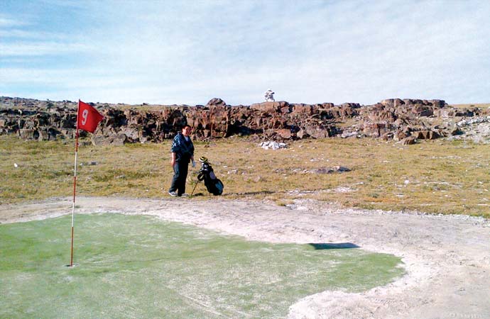
Ulukhaktok is also the home of the Billy Joss Open Golf Tournament, an annual event that is played on Canada’s most northern course under the midnight sun.
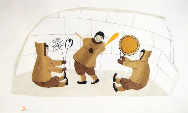
Ulukhaktok.Photo by spectacularnwt.com. Holman( now Ulukhaktok) photo taken on July 17, 2000. Photo by Ulukhaktok.comAsking for Food from Spirit . Print stonecut by E. Kengenberg/M. Nigiyok. Drum Dance . Print by Lypa Pitsiliuk.
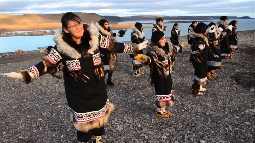
Ulukhaktok Drum Dancers. Photo by flickr.com. The most northerly 9 hole golf course in Ulukhaktok. In July 2011, they celebrated 25 years. Photo by norj.ca. Ulukhaktok Northern Lights. Photo by twitter.com.
PAULATUK—–population around 300.
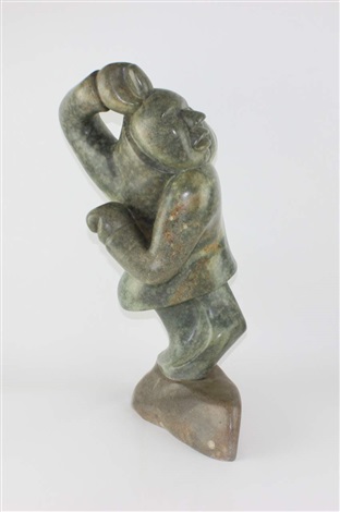
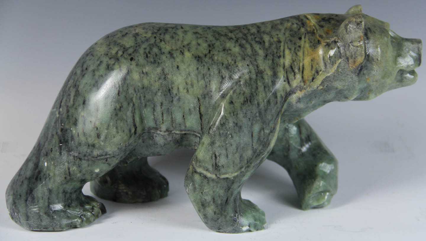
Paulatuk is a hamlet located in the Inuvik region of the North West Territories. It is adjacent to Darnley Bay in the Amundsen Gulf. The town was named for the coal that was found in the area in the 1920’s. This the Siglitun spelling is Paulatuuq, “place of coal”. Paulatuk is close to the Smoking Hills to the West . The hills have strata of lignite(brown coal) which ignite spontaneously when the hills erode. The Smoking Hills have been burning for centuries. map of Smoking Hills, Perry Peninsula and Paulatuk. Map from future Horton River TUTrips. site.google.com. C3 Canada participants in Paulatuk, NWT. Photo by canadac3.ca. Paulatuk Centre. Photo by cbc.ca. Paulatuk Moonlight Drummers and Dancers. On a Royal visit, Duke and Duchess of Cambridge , July 2011. Dave Brosha photographs. Also online by kennedy-centre.org. Paulatuk, a green stone carving of a dancer . By Abraham Anghik.
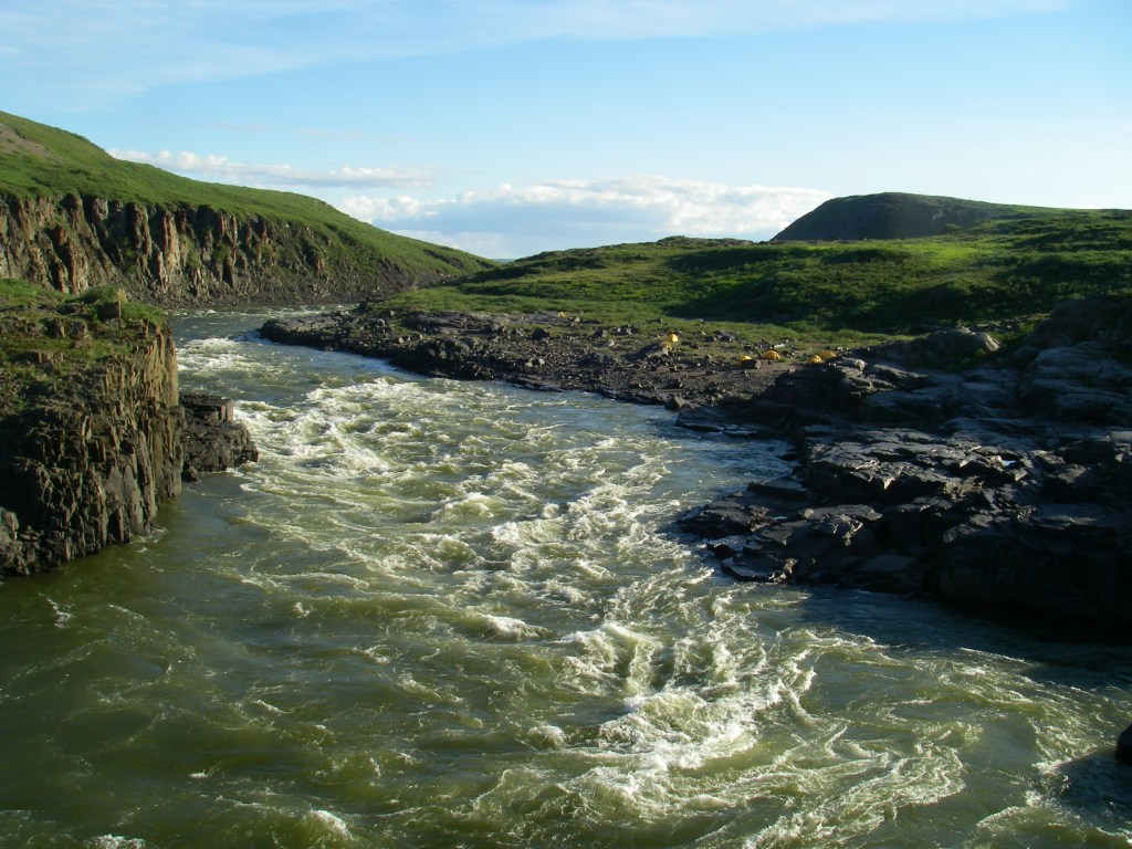
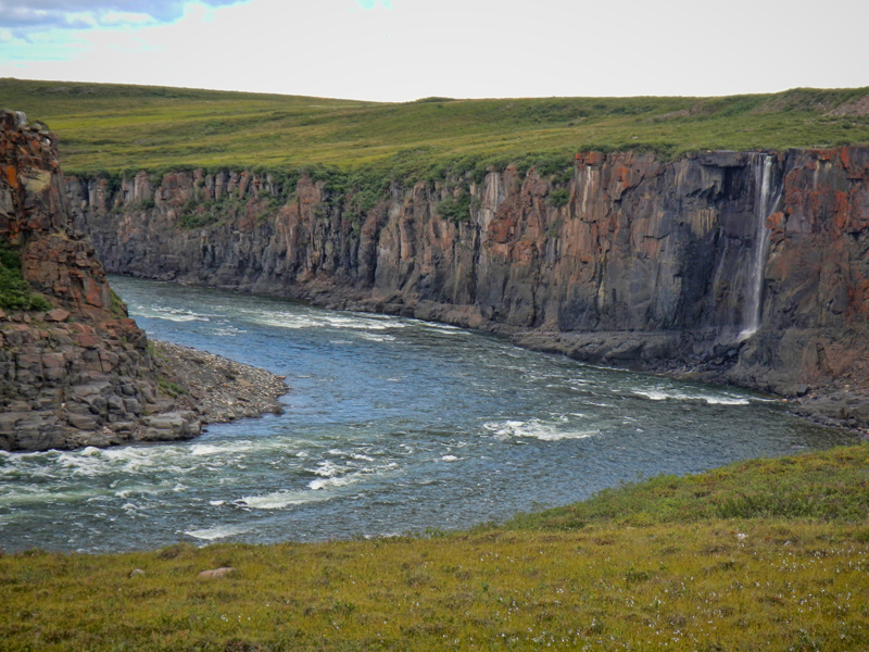
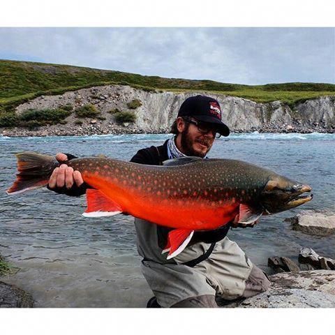
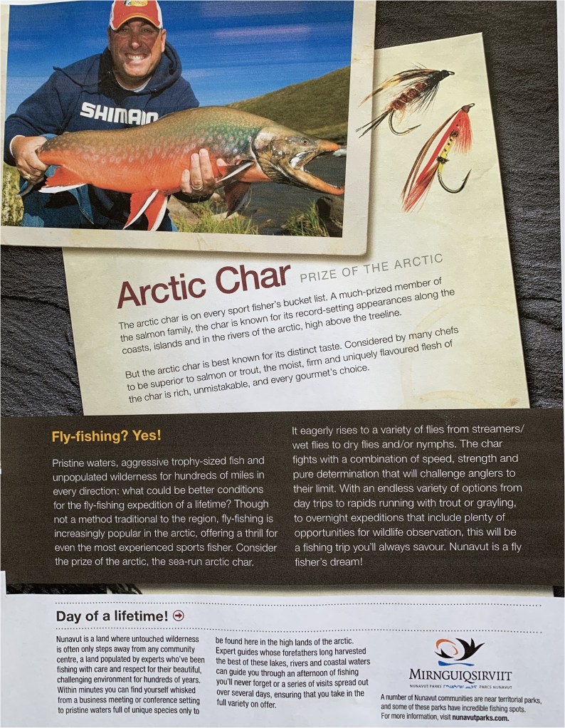
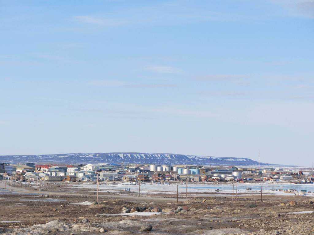
KUGLUKTUK, Nunavut. ( formerly the town of Coppermine). Population 1500. Town of Kuglutuk. Photo by nunatsiaq.com. The Coppermine River , a Canadian Heritage River, from Great Slave Lake, NWT to Kugluktuk. Kugluk(Bloody Falls) Territorial Park. Photo by en.wikipedia.org.Coppermine River. Photo by riversportadventure.com. Waterfalls on the Coppermine River .Coppermine River. Coppermine RiverKayaks on the Coppermine River. Photo by imgur.com. Arctic Char caught on Coppermine River. Photo by wikipedia.org. Arctic Grayling caught on the Coppermine River. Photo by riversportadventure.com. advertisement for Arctic Char fishing by Plummers Arctic Lodges. Also nunavutparks.com. Plummers Arctic Lodges company has many great fishing lodges in the Arctic. I remember one year my son Marc and I flew to Yellowknife then boarded a float plane to Arctic CIrcle Lodge on Great Bear Lake. I think Arctic Circle Lodge is now part of the Plummers Lodges consortium. We were there for a week fishing for lake trout and Arctic grayling. Marc caught a 16 pound Lake Trout. It takes a long time for a lake trout to get that big in the very cold great Bear Lake waters. One could take a float plane to a Plummers Lodge on the Coppermine River and fish for Arctic Char. Top Ten Rivers -Coppermine River, Tree River map. Map by arctic.uoguelph.ca. Advertisement by Plummers Arctic Lodges for fishing on the Tree River. This is a trophy river for Arctic char.
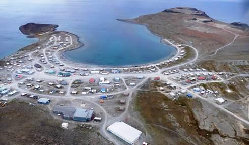
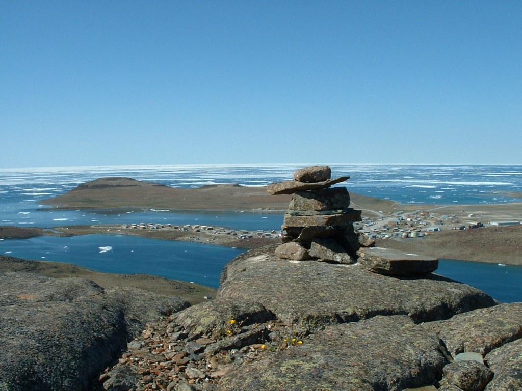
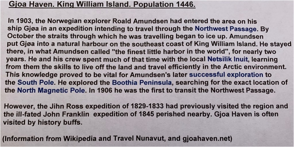
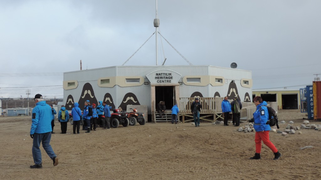
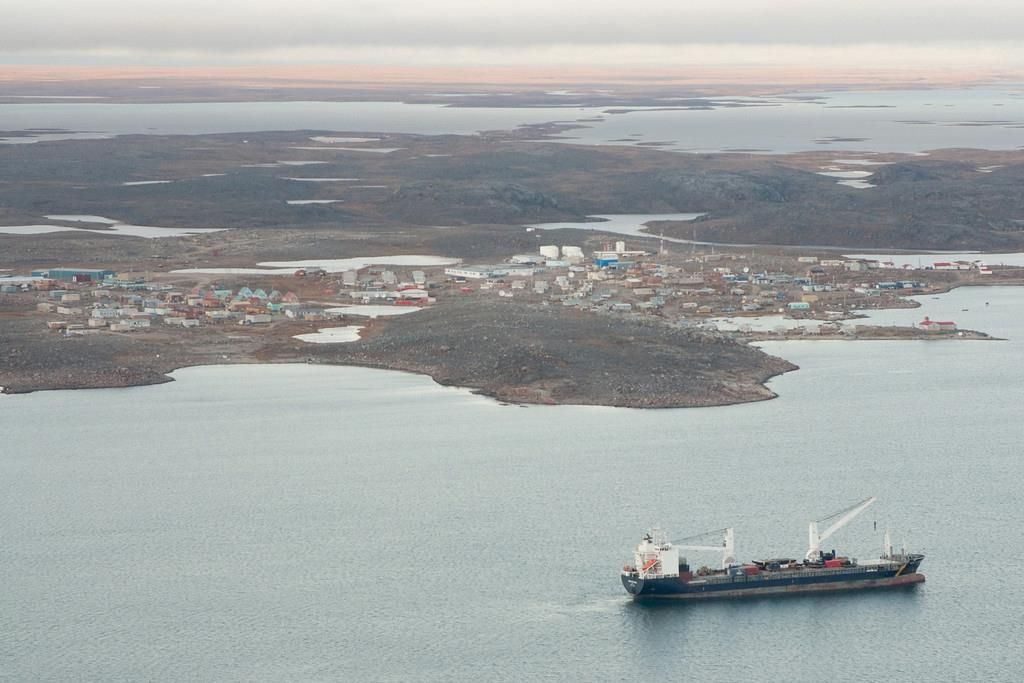
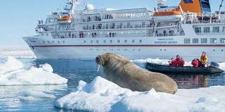
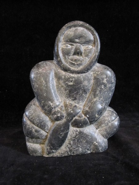
CAMBRIDGE BAY. Population 1800. It is the centre of government for the Kitikmeot,the administrative and transportation hub for this region of Nunavut. It is the largest stop for passenger and research vessels traversing the Northwest Passage. It is called Iqaluktuuttiaq because it is a good fishing place. Cambridge Bay with Mount Pelly in the background. Photo by findingtruenorth.ca.Cambridge Bay with tanker anchored . Photo by Jason Pineau Photography. Also pinterest.comCambridge Bay storage tanks on shore. Photo by cambridgebay.ca. The Crystal Serenity cruise ship anchored at Cambridge Bay. August 2016. Photo by Chris Corday/CBC. There are more and more of these cruises every year exploring the Northwest Passage and stopping at Cambridge Bay. Ovayok Territorial Park just 15 Km east of Cambridge Bay. Photo by inspirok.coGjoa Haven . Netsilik Heritage Centre. Photo by Kerry Raymond, Own Work and wikiwand.com.Gjoa Haven shoreline with Ocean Adventure Canada ship moored offshore. Photo by Kerry Raymond. Own Work. Inuit Travel Guardians on the MS Ocean Endeavour ship as part of the trial visitor experience to the wrecks of HMS Erebus and Terror national Historic Sites. Photo by Kerry Raymond-Own Work at Gjoa Haven. Sept. 2019. Gjoa Haven with some ice. Photo by seatemperature.net. Gjoa Haven-Man- serpentine stone sculpture. Photo by artmode.com
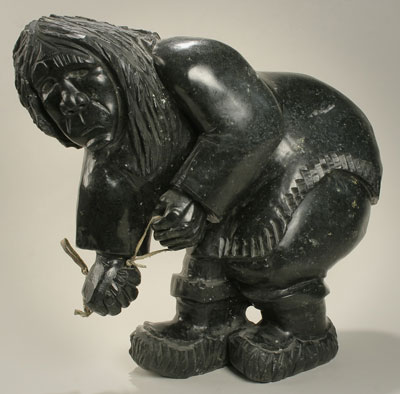
Woman with Ulu sculpture. by artist Wayne Pugigak. Gjoa Haven.
Taloyoak- population around 1100. Formerly known as Spence Bay until July 1992.
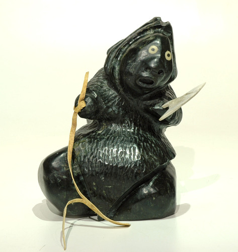
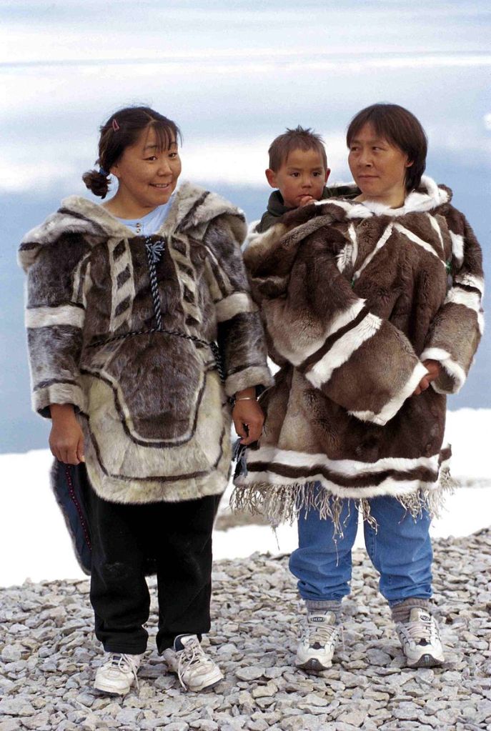
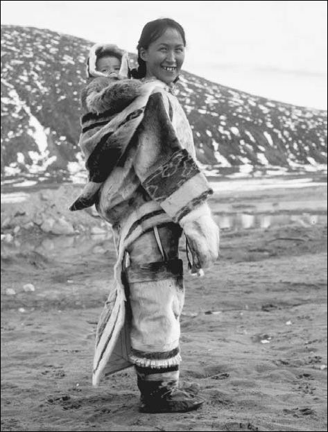
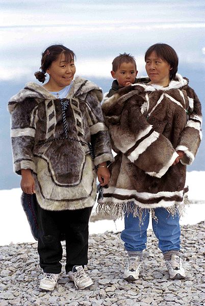
Talyoak is located on the southwestern coast of Boothia Peninsula at the Northwest Passage.It is situated just north of Shepherds Bay. The local people are Netsilik Inuit descendants of the ancient Thule culture.The hamlet name of ‘Taloyoak’ means ‘large caribou hunting blind’ in Inuktitut. These screens were built with piled stones along the caribou migration routes. Muskoxen are also found near here and the fishing is some of the best in Nunavut. The Netsilingmiut women of Taloyoak have distinctive clothing. Their amautiit (traditional parkas) are often brilliantly coloured, fringed and beaded, plus they are famous for their handmade ‘packing dolls,’ which are very popular.Artistically unique Taloyoak carvings made from stone, whalebone, caribou antler and walrus ivory frequently depict mystical subjects of ancient Inuit legend.
Taloyoak town and church. photo by wikimapia.org. Taloyoak with tanker .Photo by pinterest.com.Inuit women wearing Amautiit parkas. Photo by pinterest.comEskimo lady wearing amauti parka. Photo by pinterest.com.Eskimo clothing.Photo by reference.com Building an igloo in Taloyoak. Photo by nunavut.news.com. The cruise ship Bremen made an unscheduled stop in Taloyoak on Aug. 29,2017.The mayor was not impressed with this impromptu visit. He was concerned about the need for improved security and communications. They could have hired local people to monitor polar bears . Also with adequate notice local dancers, artists and others could have been ready to greet passengers. With increasing traffic through the Northwest Passage, this will be a future concern to be taken care of. Courtesy of nnsl.com.