My Second Year
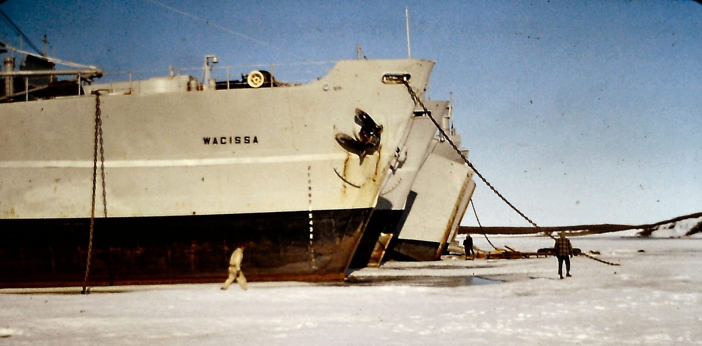
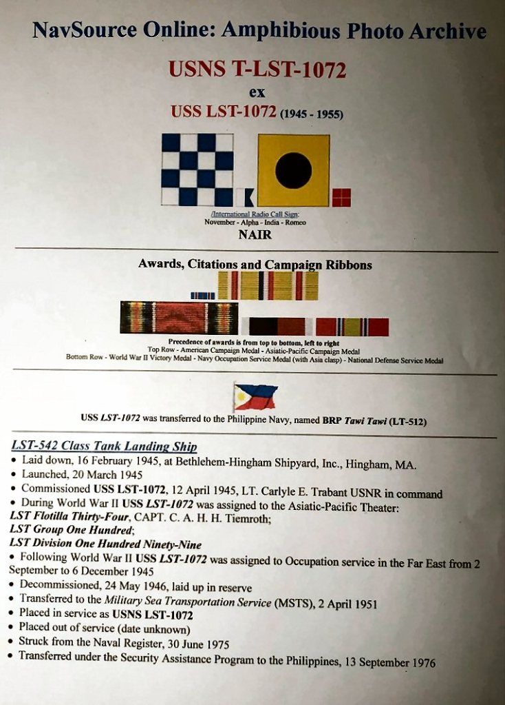
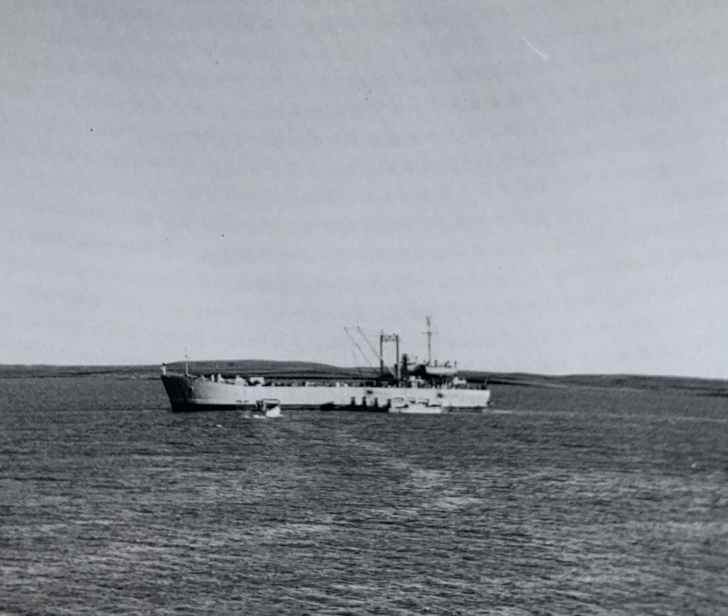
In late May we boarded the Eldorado Aviation DC-4 plane to Inuvik from the municipal airport in Edmonton. Again a transfer to a DC-3 in Inuvik to Tuktoyaktuk. Once there I was assigned as a crews mess steward aboard the LST 1072 under Captain John Allan.
There were over 1000 LST’s built for WW2. An LST could hold 16 tanks and 160 troops.

An example of LST 325 during WWII,photo by Group Town magazine, 1-st memorial.com
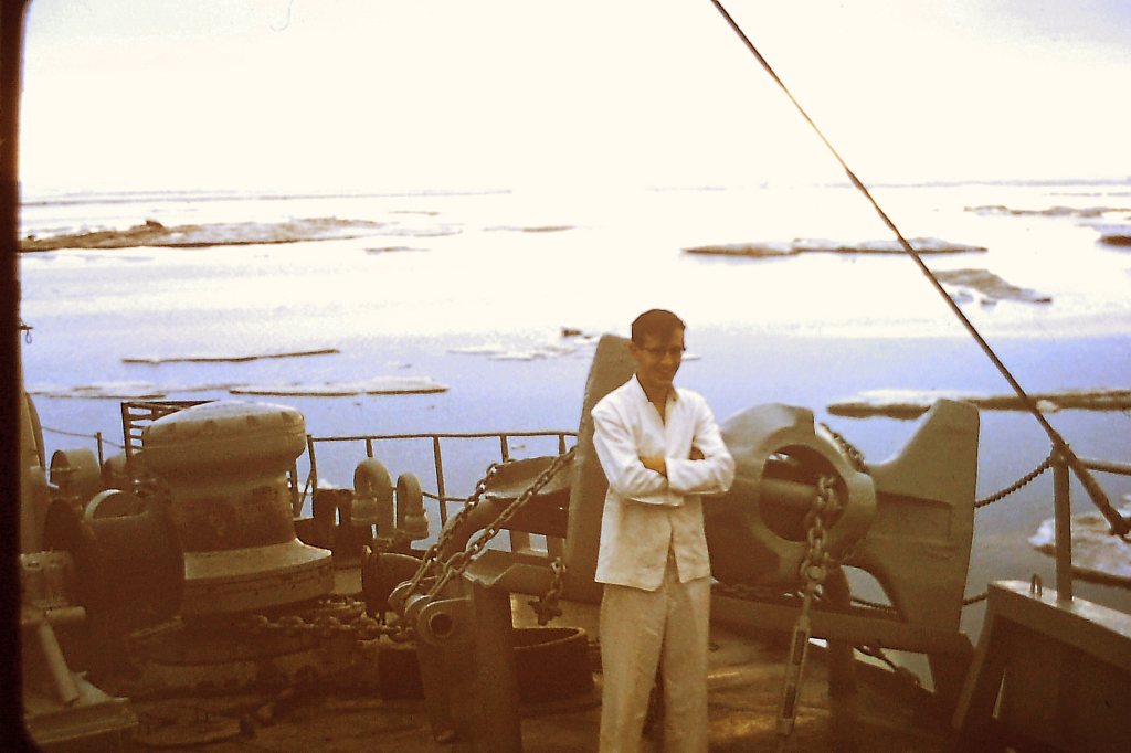
Galley boy co-worker and Crew’s Mess Steward J.L. Ares.1962.

There were 2 of us as crews mess stewards. Altogether we were 4, 2 as stewards plus 1 as cabin boy and 1 as galley boy. We slept in double bunk beds in the stern of the LST. This time I was on the lower bunk which was great. Being at the stern of the ship eventually proved to be rather noisy when the ship moved as we were immediately above the twin screw propellers. However with time we got used to the constant 24/7 drone of the propellers while the ship was sailing.
We had a wonderful Chief Steward by the name of Jim Smith from Stony Plain, Alberta. Jim was an easy going boss for us stewards and a really nice gentleman. The ship had a compliment of 8 officers such as Captain, First Mate, Second Mate, Bosun, Chief Engineer, Assistant Engineer, Radio Operator, Doctor.


had their first Canadian Tire store in Marystown on the Burin Peninsula immediately west of Placentia Bay.
There were Able Seamen and Ordinary Seamen. Many of the seamen came from Placentia Bay in Newfoundland. Placentia Bay is located at the southern end of Newfoundland between the Avalon and Burin peninsulas. In the galley, we again had the greatest cook and baker. Printed menus and choices. Unbelievable for the Arctic. The men were very well taken care of.
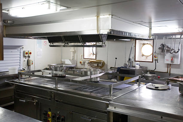
Example of a galley on an LST.Photo by Michael Smith, michael@insidelst.com

Note the printed menus at each place setting. The crew was treated really well.
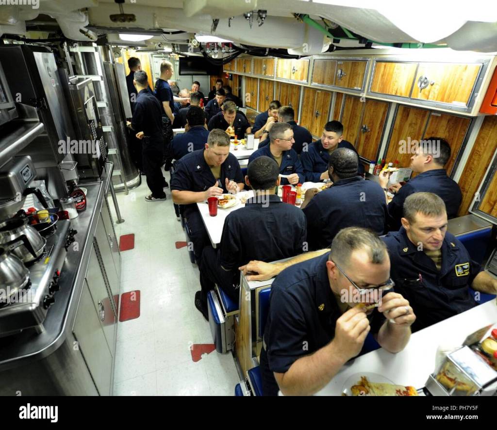
An example of a busy crews’ mess on an LST. Photo by Alamy.
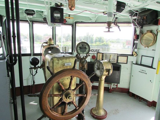
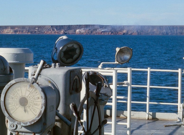
The wheelhouse on the LST. Photo from USS LST 393 Muskegon.
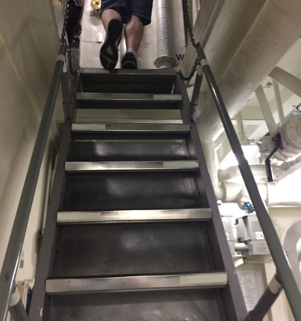
Being on an LST was a very different experience for me as now we were on a moving ship. It took a little while to find my way around the ship. The steep 45 degree stairs were a challenge especially later on as we sailed and the seas got rough. We soon learned to watch the movements of the ship from side to side, port side and starboard side, and timed our climbing and descending the stairs accordingly. The front of a boat is called the bow, while the rear of a boat is called the stern. When looking towards the bow, the left-handside of the boat is the port side. And starboard is the corresponding word for the right side of a boat. When the ship is listing 30 degrees on the port side, then it is very easy to climb the 45 degree stairs as they are now only 15 degrees. If you try and climb the same stairs when the ship is listing 30 degrees on the starboard side, then in effect you are trying to climb stairs at 75 degrees which is difficult.
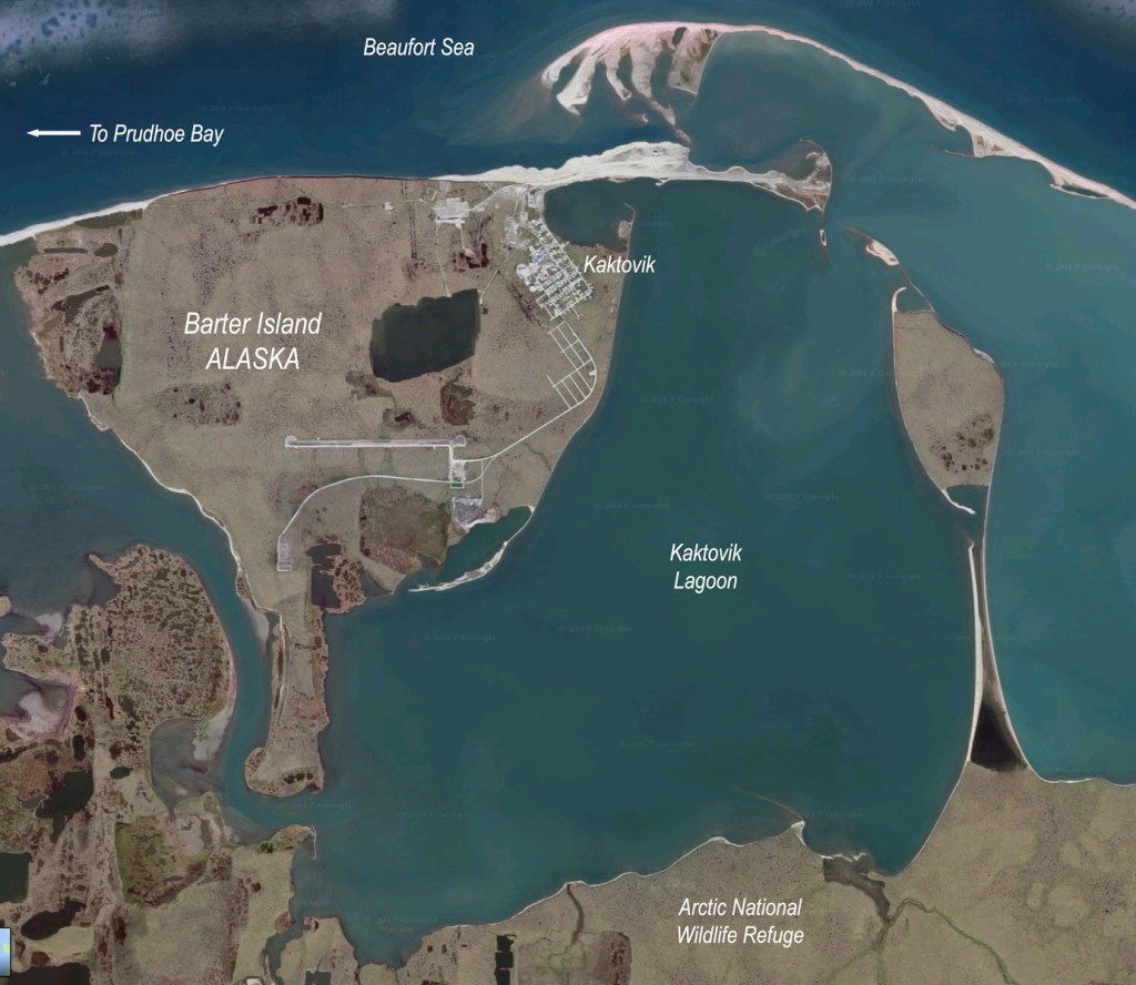
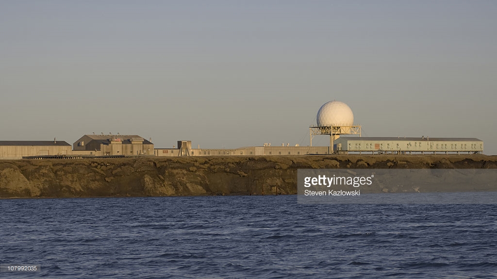
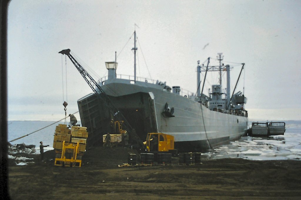
The LST consists of a really large spacious hold on the inside of the ship. A lot of cargo on pallets were loaded with forklifts into the LST at Tuktoyaktuk for sealift delivery to DEW Line sites and communities. These depended on the annual sealift for supplies. Our very first trip in June was westward. We landed in 2 DEW radar sites , Barter Island, Bar 1 DEW site in Alaska and Komakuk Beach, bar 1 DEW site in the Yukon. Yukon has a new Ivvavik National Park created in 1984, south of Herschel Island to protect a calving caribou area.

Tiny Eskimo village becomes polar bear capital of the U.S.A.
from http://www.independent.co.uk.
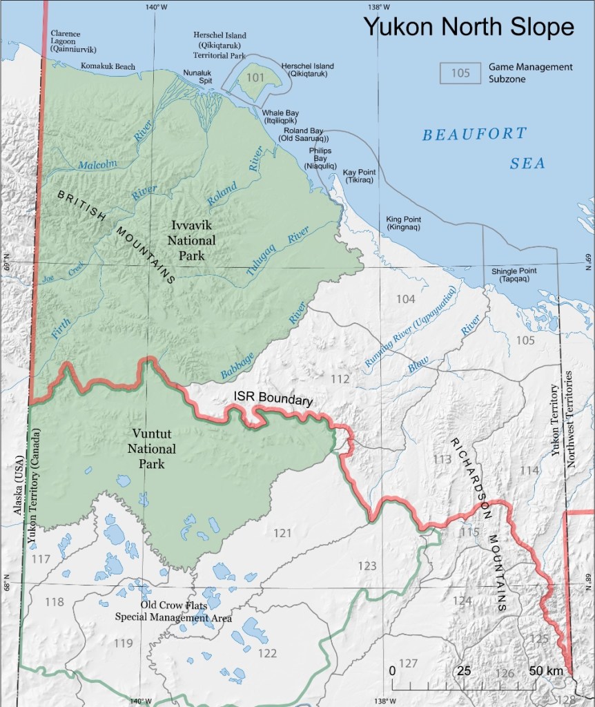
name for birthing ground, the calving area for caribou. Another park Vuntut was also created.
These parks are south of Herschel island and Komakuk Beach where we went in 1962.
Map by Wildlife Management Advisory council, north Slope. (mmacns.ca)
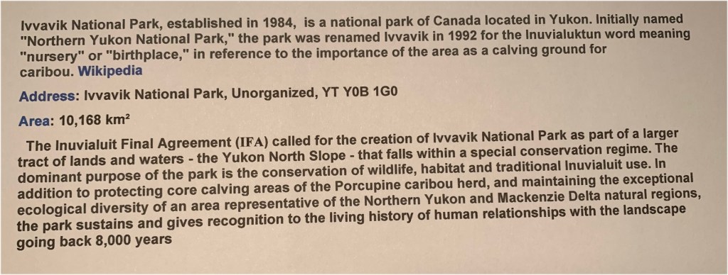

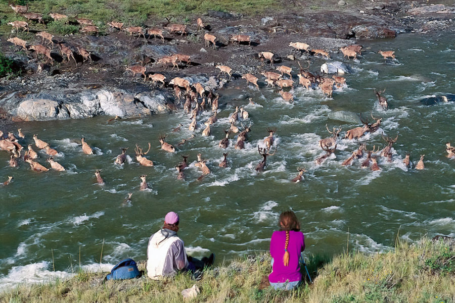

Photo by adventures.com
Yukon had 3 DEW line sites
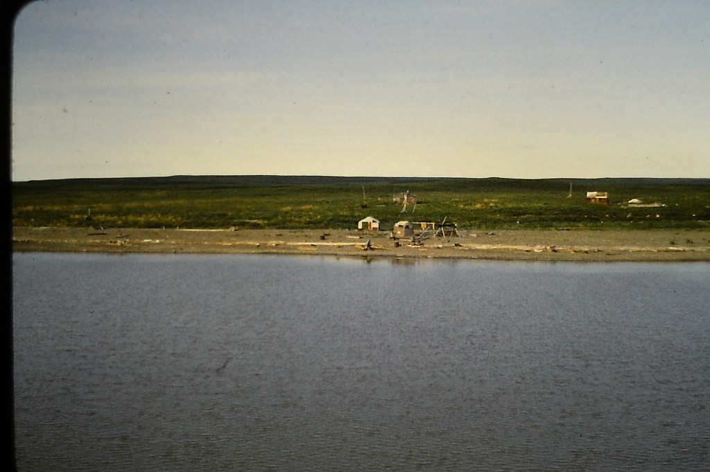
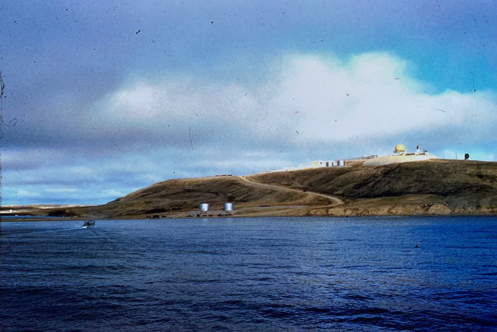
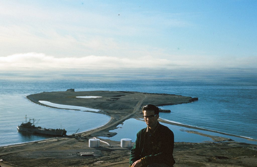
Bar 1 at Komakuk Beach, Bar B at Stokes Point, and Bar 2 at Shingle Point. We went and beached at Komakuk Beach. I took a photo there with the LST beached, a helicopter on the front deck and mountains in the distance.
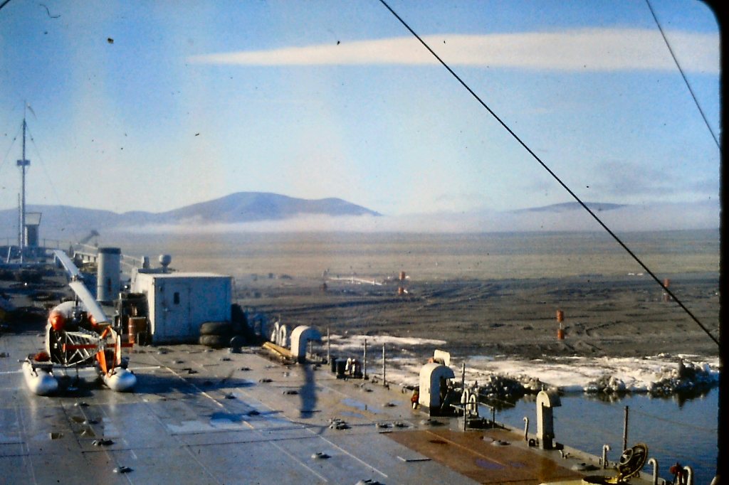
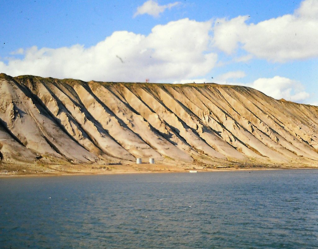
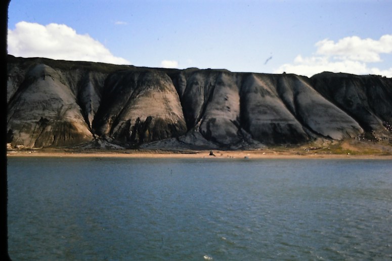
Komakuk Beach’s Bar 1 site is in a coastal plain with the Richardson mountains in the distance and is 279 Km west of Tuktoyaktuk. On the way there we passed Herschel Island, approximately 235 Km west of Tuktoyaktuk. Herschel island was famous a long time ago as a commercial bowhead whaling location in 1889. At one time there were over 1500 people living off whaling at Pauline Cove. It is Yukon’s only island. The island was discovered in 1826 by Sir John Franklin. It has since been vacated and only historical evidence and artifacts remain. Herschel Island is uninhabited which is sad considering it’s illustrious history as an very important Bowhead whaling station. It is still a historic Canadian site but losing ground every year as the permafrost is eroding away and it is losing a lot of its surface due to climate change and more severe storms.

http://www.smithsonianmag.com

CLIMATE CHANGE AND GLOBAL WARMING. COASTAL AND PERMAFROST EROSION.

Photo by blogs.helmholtz.de
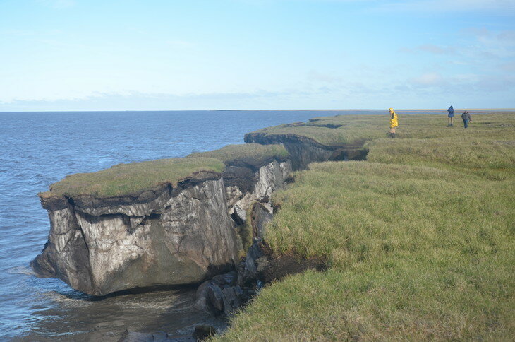
Photo by Phys.org
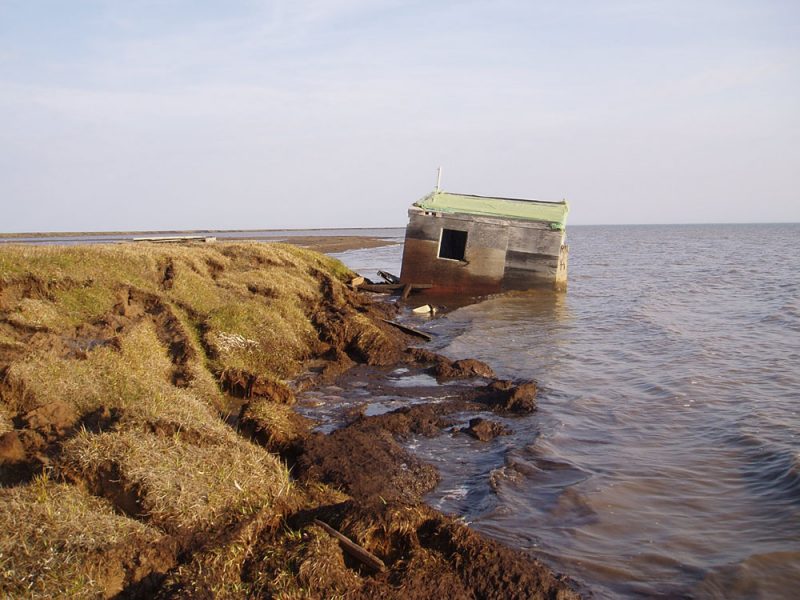

Photo by Roger MacLeod, Natural Resources Canada.


as a white fox trapper. White fox pelts were worth a lot of money and the 1920s became a time of tremendous prosperity
for many Inuvialuit trappers. They could afford expensive schooners and by 1925 Nuligak was able to buy his own.
He ordered a schooner from the Northern Trading Company and the Bonnie Belle was delivered to him in 1926.
Nuligak described this brand new, forty-foot schooner as having a “Francisco Standard heavy duty ten horsepower
machine-to-make-fire.”
from Explore Aklarvik, nwtexhibits.ca
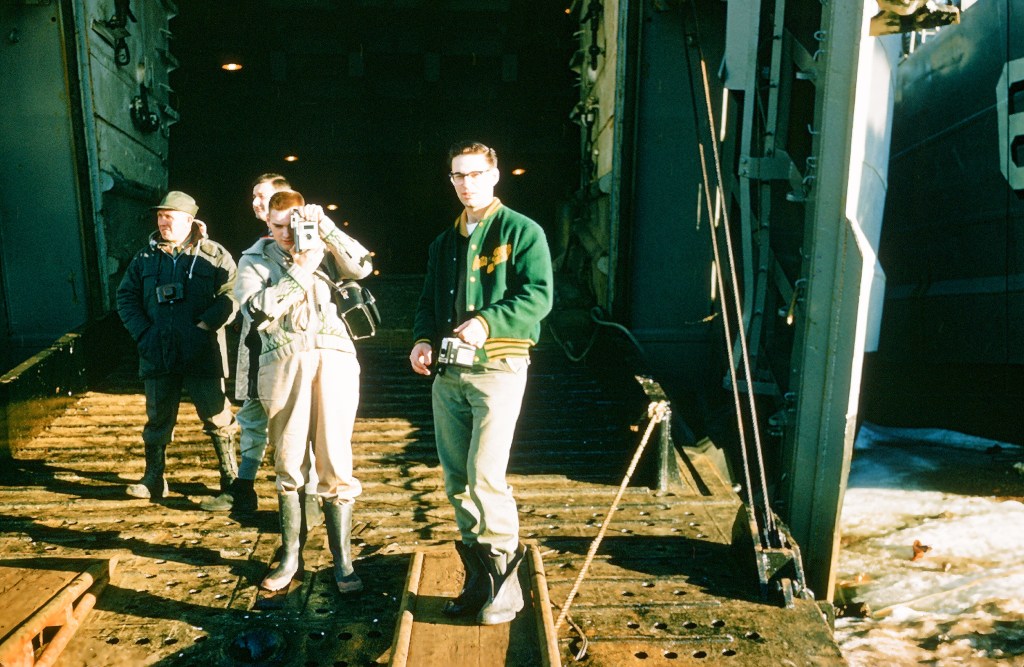
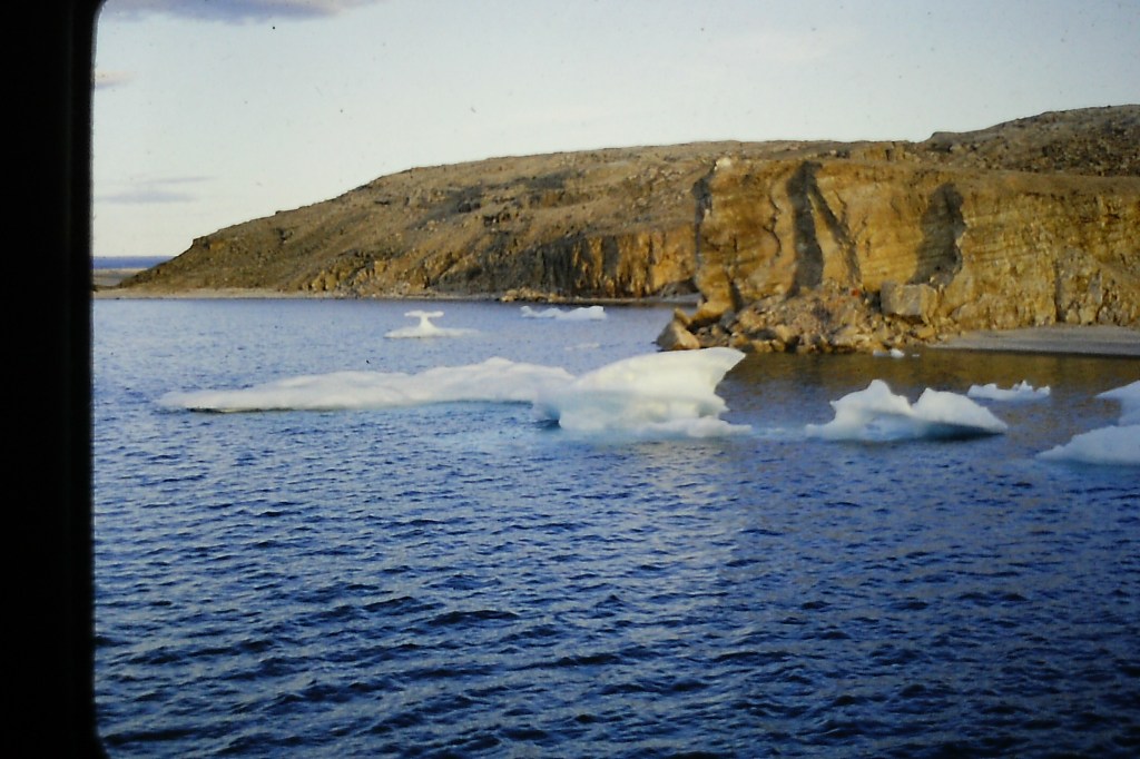
On the way to Komakuk Beach we encountered a lot of ice. We could feel the LST bumping and crushing into the ice packs. The ship would slide up the ice and then come down on the ice breaking it up. Our ship would back up and then take another run at the ice, ramming it, coming on top of it and then dropping down again. Back and forth this carried on. The LST 1072 had a helicopter on board, an Okanagan helicopter. It would fly ahead and try and find an easier way through the ice.


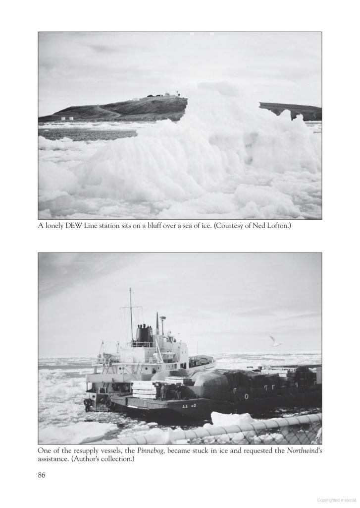
The above 2 photos, courtesy of Ted Lofton, illustrate the ever-present problem of shipping in the Arctic. The first photo is of Pin Main, which we visited a few times in 1962 and 1963. The second is of the tanker Pinnebog stuck in the ice . I did not work on this tanker, but my brothers, Georges and Richard did.
We returned to Tuktoyaktuk and reloaded the LST 1072. Now we were heading East to Pin Main, a main DEW line radar site on Cape Parry, 537 Km east of Tuktoyaktuk. On the way there we passed the long stretch (60 Km) of Smoking Hills (aka Malloch Hills) in Franklin Bay near Paulatuk and Horton River.
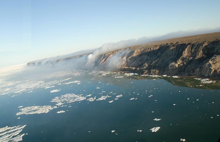

We could easily see the smoke from the ship. They have been burning for centuries. Deposits of lignite light up spontaneously when the hills erode and the lignite is exposed to air. In 1998, the new Tuktut Nogait National Park along the spectacular Hornaday River was established in this area.

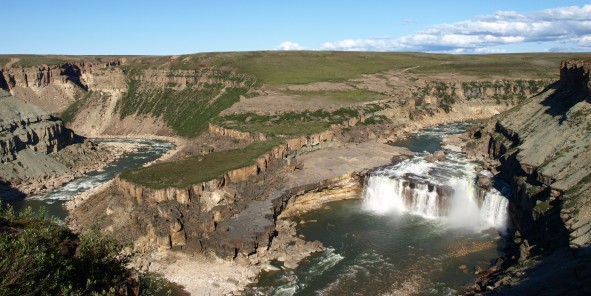

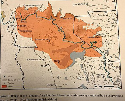
The Bluenose East caribou herd’s calving grounds are in this park and recovery of the caribou is ongoing.
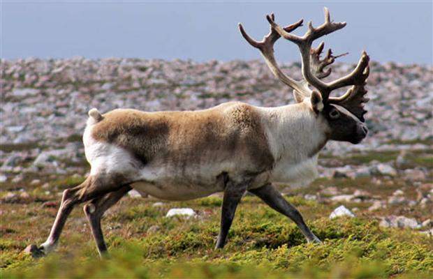
We did not see any caribou on our trip.

Photo by yukon.ca

Caribou herd in winter, cannot remember the site and person for photo credit. It is a wonderful photo. Could be Nat. Geograhic.
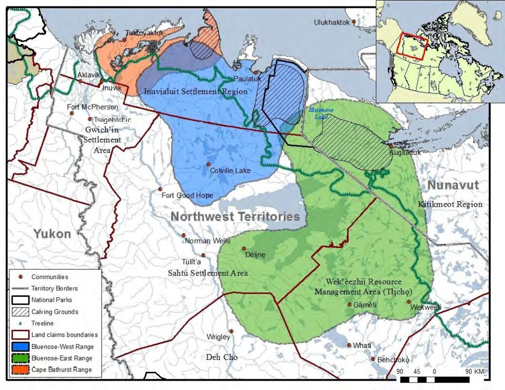
Caribou ranges maps courtesy of cbc.ca and wrrb.ca.
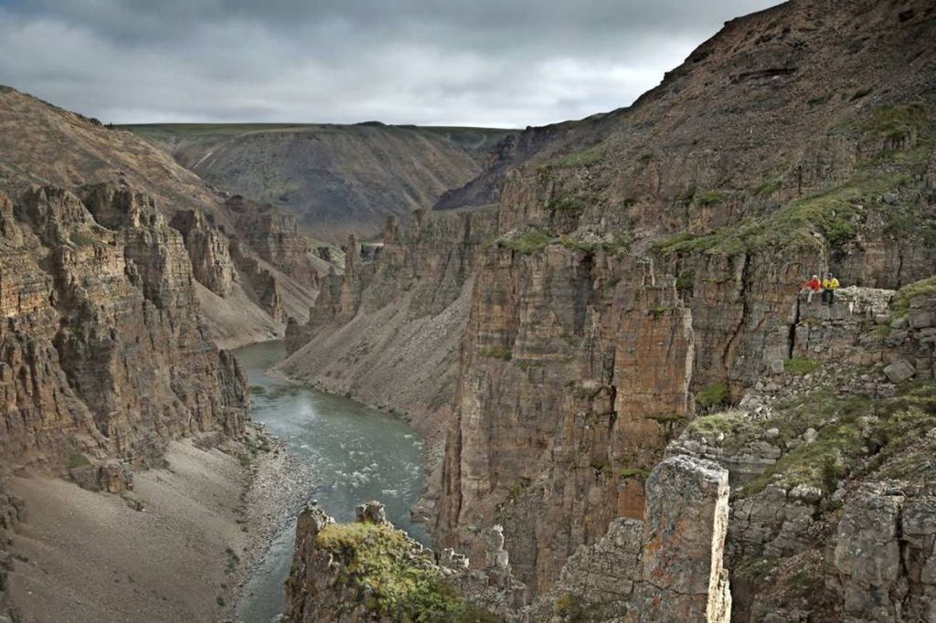
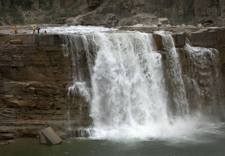
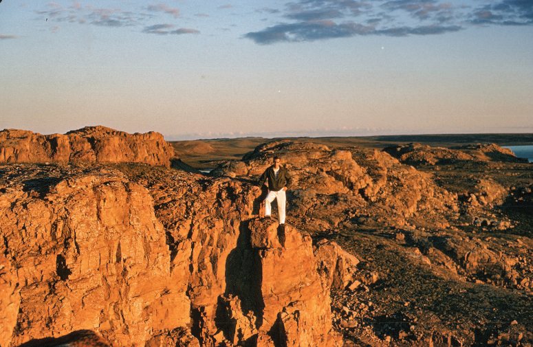
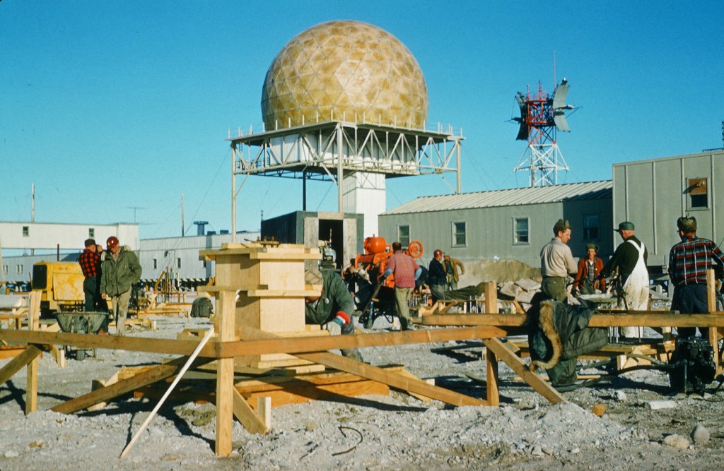
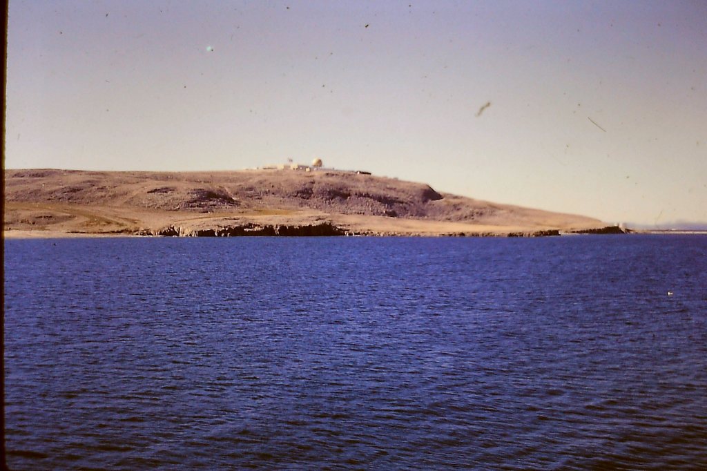
Our first stop was the Bar E DEW line site at Horton River (aka Malloch Hills). There are really high impressive cliffs at this site and the radar site facilities are right at the top. I took many photos of these cliffs. Word was that a funicular escalator(mechanical lift) carried cargo up to the top. There were storage tanks down below at the shore line.

Photo is courtesy of Landfill Remediation at Former Military Radar Sites-NATO-CCM5 Cardiff, U.K. May 23-26, 2004.


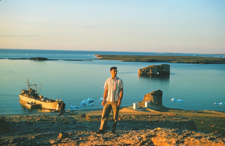
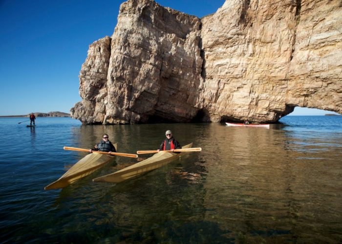
The next stop going East was Pin A at Pearce Point. From up high, the scenery is spectacular of Pearce Point Harbour. I have a photo of myself on a hill showing the beached LST 1072 down below and next to it a huge brown pierced rock in the water. This limestone island is called Pearce Island in Pearce Point Harbour. This reminded me of Roche Perce in Gaspe, Quebec. We took many photos here.


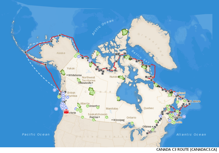
In 2017, the Canada C3 Polar Prince ship did a 150 day expedition from Toronto to Victoria via the NorthWest Passage. They then made their way to the jaw-dropping Pearce Point Harbour on Sept.5,2017, a site with spectacular rocky beaches and also a rich history – another DEW Line station, Pin A, can be found here, and the Canadian Arctic Expedition also came through this area. Excellencies Governor General David Johnston and Sharon Johnston also enjoyed kayaking in the sunshine, and paddled through a particularly special rock formation.

All photos by canadac3.ca
Check out a 2 minute video taken by Canada C3 at Pearce Point Harbour. The web site is misspelled as ” Pierce Point Harbour -Canada C3″. The video shows all the kayakers paddling through the hole in the rock.
In the Crews Mess during the evenings we had many interesting and fun conversations with the AB and Ordinary seamen from Newfoundland. They were very gentle and friendly people and had the peculiar “Newfie accent”. Not trying to be snobbish or condescending we tried to imitate that accent. A few did not read or write but were exceedingly great seamen and wonderful personalities with a great sense of humor. I will always remember some expressions “Sure is some bad, my son”, “Yes, b’y”, Whadda y’at?, Where y’ longs to?, Who knit ya?Where y’ longs to?
We watched the latest movies showing in US theatres, we would exchange movies as we went from DEW line site to another. Uncle SAM made this possible, sometimes by helicopter. Many evenings were spent around the mess tables playing cards, such as hearts, crib, and all kinds of poker. Unfortunately some players lost quite a bit of money. Being a University student in first year Dentistry and needing all my hard earned money I stayed away from poker games. I did a lot of reading in my bunk at the stern end of the ship. Also I spent a lot of time writing letters to my girlfriend Mena Duchscherer, a U.of A. Education student ,who at the time worked in Banff for the summer. Mena worked at a hamburger joint on Banff Avenue called the Jiffy Bar. I had met her at a Catholic Newman Club dance at the University of Alberta campus in the fall of 1961. We wrote lots of letters to each other over the summer.
After Pin Main we headed further East again for the Cam Main Dew line site at Cambridge Bay on the south end of Victoria Island. Cambridge Bay is 1091 Km east of Tuktoyaktuk. The population is around 1800 people.Cambridge Bay is now in Nunavut and not part of North West Territories any more.
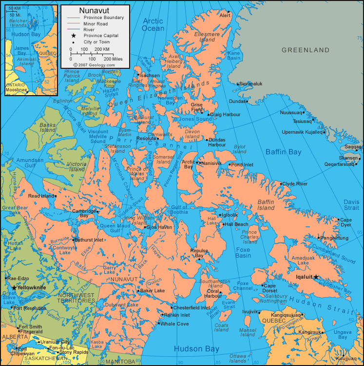


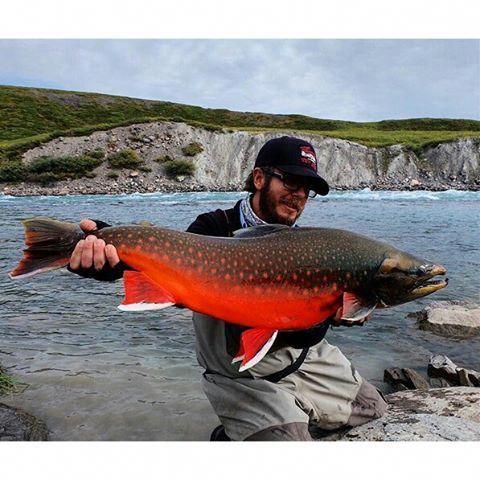
Cambridge Bay is in the Kitikmeot region of Nunavut now. The Inuit name is “Iqaluktuuttiak” which means good fishing place, a great fishing area for Arctic Char. The Norwegian explorer Roald Amunsden visited the Cambridge Bay area on his ship “Gjoa” in 1905 when he discovered the Northwest Passage. Unlike many DEW line radar sites which were abandoned and closed Cam Main remains a manual operation as part of the North Warning system.


We did pass Kugluktuk, 745 Km east of Tuktoyaktuk, population around 1500 on the way east to Cambridge Bay. The old name was Coppermine and it is at the mouth of the Coppermine River. We did not stop there. This river is famous for its Arctic char fishing. Years ago, my son Marc and I went fishing at Arctic Circle Lodge on Great Bear Lake. From there you could take a helicopter ride to go fishing for Arctic char on the Coppermine River. There are numerous tours that can take you on this great Canadian Heritage river.
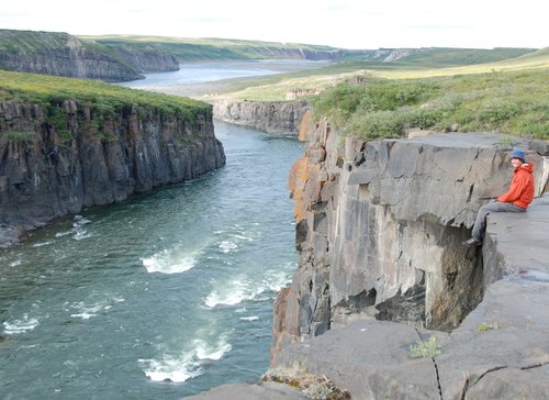
Photo by nahanniwild.com
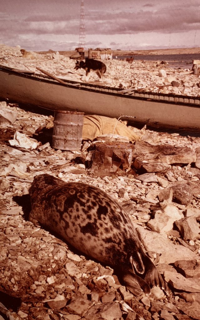
We did get off the boat and walked around the Cam Main DEW line site. There were dead seals on the shoreline. We took a photo of one of the seals that the local Inuit had harvested.
We were shocked by the huge amount of empty barrels stacked up in rows near the shore, possibly a lot of leakage could be occurring. A big concern for us was possible soil contamination by oil and gas. Hopefully eventually these would be removed and the area cleaned up as remediation eventually began at many of the closed DEW line sites across the Arctic.
Toward the end of the shipping season, after Cambridge Bay, the last site the LST 1072 visited was Cam C , Shepherd Bay, population 200 and Spence Bay, now known as Taloyoak, population 1029, both on the Boothia Peninsula, Nunavut. This is the farthest east that Operation Sealift works in the Western Arctic. Shepherd Bay is 1530 Km east of Tuktoyaktuk, Taloyoak just a bit further north.
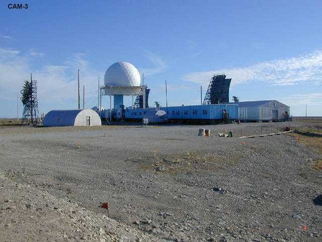

Photo by pinterest.com

Photo by wikimapia.org
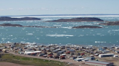
Photo by seatemperature.net
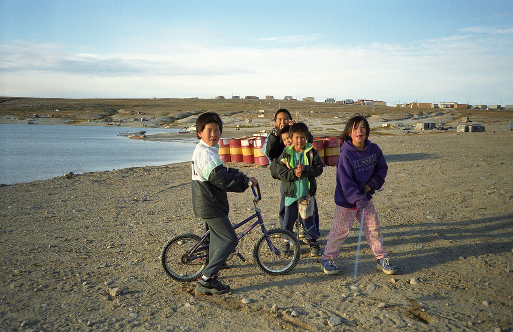
Photo by Frank Kuin. flickr.com

Photo on pinterest.com
On the way to Shepherd Bay and Taloyoak we passed the following DEW line sites: Cam B on Hat Island, Cam 1 on Jenny Lind Island , Cam 2 Gladman Point, Cam CB at Gjoa Haven on King William Island. We did not stop at these sites.
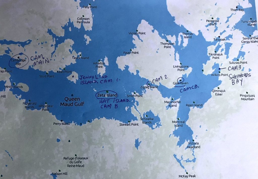
Map by Wikipedia.
King William Island is now famous as this is where Sir John Franklin‘s 2 ships were found, the “Erebus” and the “Terror”. “Erebus” was found on the north west side of the island and “Terror” was found south of King William Island and on the north west corner of the Adelaide peninsula on mainland Nunavut. Both ships were abandoned in April 1848 north west of King William Island in Victoria Gulf. Now, that both Franklin’s ships have been discovered, it’s hard to believe we actually sailed a few times back and forth across this area. I get emotional when I think of this tragedy and what happened to all those men over the ensuing 2 years after they died trying to walk south and find help. There were many artifacts found on the west and south coast of King William Island.

Photo by pinterest.com
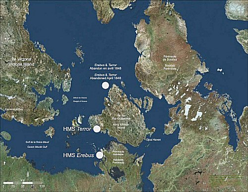
The wreck of Erebus found on the northern end of the Adelaide Peninsula.
Credit: Parks Canada.
While unloading cargo at Shepherd Bay, the LST was all of a sudden totally surrounded and blocked in an ice pack. We waited, and lo and behold, the wind changed, the ice pack disappeared and the next day we were able to depart for Tuktoyaktuk. It is amazing how fast that ice can move in the Arctic.
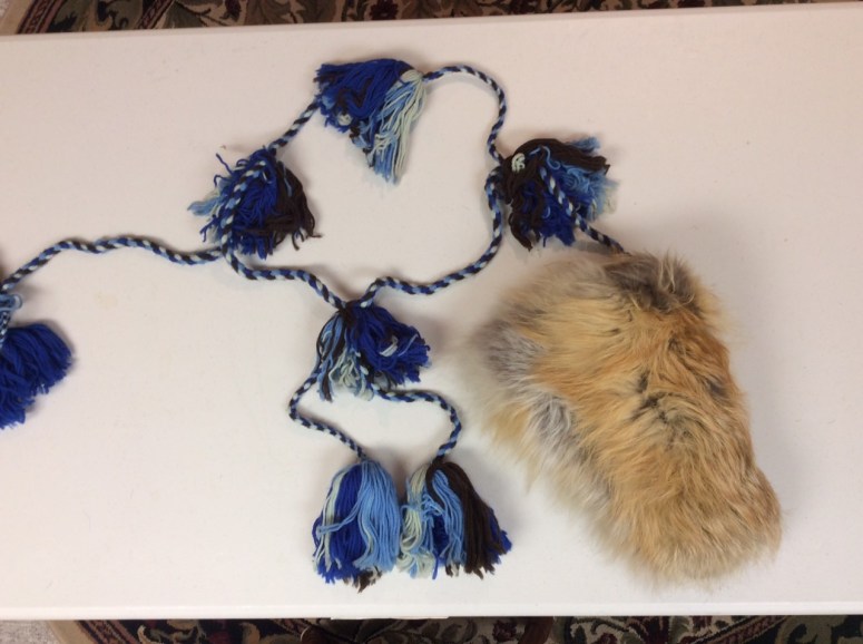
Before leaving Tuktoyaktuk back to Edmonton we went shopping at the Hudson Bay Store. I purchased souvenirs for people back home, my girlfriend and younger sister Jacqueline. I bought the so called “Idiot Mittens” and mukluks, fur dolls, soapstone carvings.

Idiot Mittens: Many Inuit people make a colorful four-strand braid harness for their mittens. Worn over a parka, the harness allows the mittens to hang freely in a position where they may easily be retrieved when needed. The mittens are attached by a leather thong embedded in the thumbside mitten seam around the lower tassels. The top tassel hangs decoratively below the parka hood in the back. This way you never lose your mittens especially on a very cold day. I have photos of these in my photo archives. They can be very colorful.

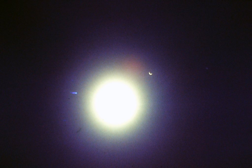
After that, we made it back to Edmonton in early September and was on time for starting my second year of Dentistry. It was always nice to get back home to Edmonton and not worry about setting tables, serving the crew and cleaning up afterwards for many people. I did however really enjoy my time in the Arctic and working on the LST that summer. It was an unforgettable experience and we got to see and experience a part of Canada that many people will never see. While we were up on the Arctic Ocean that 1962 summer there was a total eclipse of the sun and we all got to watch it with welders goggles. Even took photos of it through welders goggles.